Zámořská Francie
.svg)

Zámořská Francie (francouzsky France d'outre-mer) je souhrnné pojmenování pro ta území a teritoria, které spadají pod francouzskou suverenitu, ale neleží v Evropě, v tzv. Metropolitní Francii. Běžně se pro ně používá zkratka DROM-COM (Départements et régions d'outre-mer - Collectivités d'outre-mer) a jsou rozesety po celé Zemi – v Tichém, Indickém a Atlantském oceánu, Karibiku, Jižní Americe a Antarktidě. Jedná se o zbytek dříve mnohem rozsáhlejší francouzské koloniální říše.
Přehled území
Podle vztahu zámořského území k Francouzské republice rozlišuje několik různých druhů právních statusů zámořských území. Jsou to:
- Zámořský departement a region: zkratka DOM-ROM, jsou plně integrovanou součástí Francie.
- Zámořské společenství: zkratka COM, má jiné postavení než DOM-ROM, ale je hodně podobné funkci departementu.
- Společenství sui generis je obdobou Zámořských společenství, ale má vyšší stupeň autonomnosti a volnější svazek s Francií
- Zámořské teritorium je speciální status, který mají pouze Francouzská jižní a antarktická území
- Soukromé vlastnictví státu je řízeno přímo hlavou státu – prezidentem, ten ale může jmenovat svého zástupce, kterého pověří správou tohoto území — Clippertonův ostrov
Následující tabulka obsahuje informace platné k 1.1.2021.
| Území | Kód INSEE | Kód ISO 3166-1[1] | Vztah k Francii | Lokalizace | Počet poslanců[2] | Počet senátorů[2] | Vztah k Evropské unii[3][4] | Geodata |
|---|---|---|---|---|---|---|---|---|
| Guadeloupe | 971 | GP | zámořský region a zám. departement | Karibik | 4 | 3 | nejvzdálenější region | OSM, WMF |
| Martinik | 972 | MQ | collectivité territoriale unique | Karibik | 4 | 2 | nejvzdálenější region | OSM, WMF |
| Guyana | 973 | GF | collectivité territoriale unique | Jižní Amerika | 2 | 2 | nejvzdálenější region | OSM, WMF |
| Réunion | 974 | RE | zámořský region a zám. departement | Indický oceán | 7 | 4 | nejvzdálenější region | OSM, WMF |
| Mayotte | 976 | YT | collectivité territoriale unique | Indický oceán | 2 | 2 | nejvzdálenější region | OSM, WMF |
| Saint Pierre a Miquelon | 975 | PM | zámořské společenství | Atlantský oceán | 1 | 1 | zámořská země a území | OSM, WMF |
| Svatý Bartoloměj | 977 | BL | zámořské společenství | Karibik | 1[p 1] | 1 | zámořská země a území | OSM, WMF |
| Svatý Martin | 978 | MF | zámořské společenství | Karibik | 1[p 1] | 1 | nejvzdálenější region | OSM, WMF |
| Wallis a Futuna | 986 | WF | zámořské společenství | Pacifik – Melanésie | 1 | 1 | zámořská země a území | OSM, WMF |
| Francouzská Polynésie | 987 | PF | zámořské společenství | Pacifik – Polynésie | 3 | 2 | zámořská země a území | OSM, WMF |
| Nová Kaledonie | 988 | NC | společenství sui generis | Pacifik – Melanésie | 2 | 2 | zámořská země a území | OSM, WMF |
| Francouzská jižní a antarktická území | 984 | TF | zámořské teritorium | Indický oceán, Antarktida | — | — | zámořská země a území | OSM, WMF |
| Clippertonův ostrov | 989 | — | soukromé vlastnictví státu | Pacifik | — | — | — | OSM, WMF |
Francouzská jižní a antarktická území a Clippertonův ostrov nejsou trvale osídleny. Všechna ostatní obydlená území mají své zástupce ve francouzském parlamentu – 27 v Národním shromáždění a 21 v Senátu.[2] V Zámořské Francii se stejně jako v Metropolitní platí eurem (EUR). Výjimkou jsou 3 území v Pacifiku, která používají CFP frank (kód XPF). Ten je pevně svázán s eurem v poměru 1 XPF = 0,00838 EUR.[5]
Základní údaje
Osídlená území
| Místní neoficiální vlajka | Území | Hlavní město | Obyvatelstvo | Rok určení počtu obyvatel[6][7] | Rozloha[8] | Hustota zalidnění | HDP (2019)[9] | HDP na hlavu |
|---|---|---|---|---|---|---|---|---|
 | Francouzská Guyana | Cayenne | 276 128 obyv. | 2018 | 83 534 km² | 3,3 obyv./km² | 4,4 miliard € | 15 935 €/rok/ob. |
 | Francouzská Polynésie | Papeete | 281 674 obyv. | 2017 | 3 521 km² | 80,0 obyv./km² | 5,09 miliard € | 18 071 €/rok/ob. |
| Guadeloupe | Basse-Terre | 387 629 obyv. | 2018 | 1 628 km² | 238,1 obyv./km² | 8,8 miliard € | 22 702 €/rok/ob. | |
 | Martinik | Fort-de-France | 368 783 obyv. | 2018 | 1 128 km² | 326,9 obyv./km² | 9,0 miliard € | 24 405 €/rok/ob. |
.svg) | Mayotte | Mamoudzou | 262 895 obyv. | 2017 | 374 km² | 702,9 obyv./km² | 2,2 miliard € | 9 129 €/rok/ob. |
| Nová Kaledonie | Nouméa | 326 541 obyv. | 2019 | 18 576 km² | 17,6 obyv./km² | 8,4 miliard € | 25 724 €/rok/ob. | |
.svg) | Réunion | Saint-Denis | 855 961 obyv. | 2018 | 2 504 km² | 341,8 obyv./km² | 19,1 miliard € | 22 314 €/rok/ob. |
 | Saint Pierre a Miquelon | Saint-Pierre | 5 985 obyv. | 2018 | 242 km² | 24,7 obyv./km² | ||
.svg) | Svatý Bartoloměj | Gustavia | 10 124 obyv. | 2018 | 24 km² | 421,8 obyv./km² | ||
| Svatý Martin | Marigot | 34 065 obyv. | 2018 | 56 km² | 608,3 obyv./km² | |||
 | Wallis a Futuna | Matāʻutu | 12 067 obyv. | 2018 | 142 km² | 85,01 obyv./km² | ||
| CELKEM | 2 821 852 obyv. | 111 729 km² |
Fotogalerie
 Martinik
 Guadeloupe
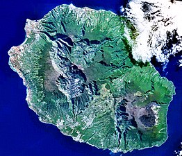 Réunion
 (c) ESA, CC BY-SA 3.0 igoFr. Guyana
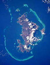 Mayotte
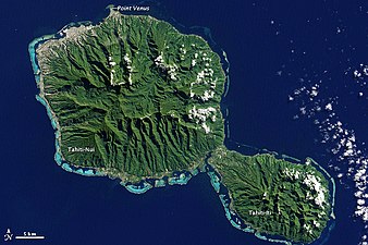 Tahiti – hlavní ostrov Fr. Polynésie


 Nová Kaledonie
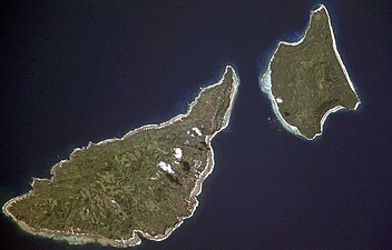 Futuna
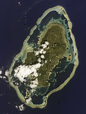 Wallis
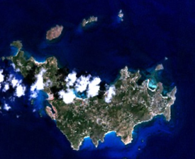 Saint-Barthélemy
 Saint-Martin
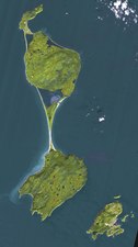 Saint Pierre a Miquelon


Území bez trvalé populace
Do této kategorie spadají ostrov Clipperton, který má rozlohu 9 km² se nachází v Pacifiku u mexického pobřeží, a Francouzská jižní a antarktická území (zkratka TAAF). Ty sestávají z pěti distriktů (Ostrovy Svatý Pavel a Amsterdam, Crozetovy ostrovy, Kergueleny, Roztroušené ostrovy[p 2] a Adélina země) a nacházejí se v jižním Indickém oceánu a Antarktidě.
V roce 1961 vstoupila v platnost tzv. washingtonská Smlouva o Antarktidě (v ČR provedena zákonem č. 276/2003 Sb. o Antarktidě a o změně některých zákonů), ve které se mj. zúčastněné země zavázaly po dobu platností smlouvy zakonzervovat rozdělení Antarktidy mezi jednotlivé země podle stavu z roku 1959, ale zároveň tato vlastnická práva neuplatňovat. Francie, signatář smlouvy, shodně s ostatními zeměmi na svých pozastavených právech trvá, ale v duchu přijaté smlouvy v praxi je neuplatňuje. Adélina země je proto součásti TAAF ryze formálně.[10] Celková rozloha TAAF bez započítání Adéliny země je 7 665 km²[11]
Fotogalerie
 Clipperton
 Amsterdam
 Svatý Pavel
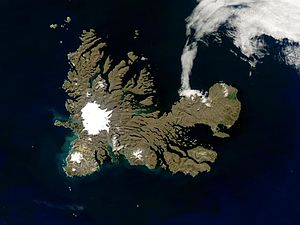 Kergueleny
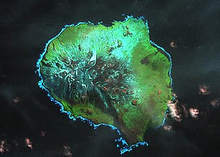 Crozetovy ostrovy – Île aux Cochons
 Crozetovy ostrovy – Île de la Possession a Île de l'Est
 Roztroušené ostrovy – Glorieuses
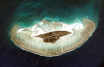 Roztroušené ostrovy – Juan de Nova
 Roztroušené ostrovy – Bassas da India
 Roztroušené ostrovy – Tromelin
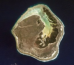 Roztroušené ostrovy – Europa

.jpg)
Zajímavosti
- Zámořská Francie leží celkem v 9 časových pásmech.
- Souhrnná rozloha Zámořské Francie je srovnatelná např. s územím celého Bulharska (110 910 km²).
- Zámořská Francie představuje téměř 18% veškerých území spadajících pod francouzskou suverenitu. Metropolitní Francie se rozkládá na ploše 543 965 km².[12][13]
- Počtem obyvatel je Zámořská Francie srovnatelná např. s Mongolskem (2 629 000 obyvatel).
Odkazy
Poznámky
- ↑ a b Svatý Martin a Svatý Bartoloměj mají jednoho společného zástupce ve francouzském parlamentu.
- ↑ součástí Roztroušených ostrovů jsou: Bassas da India, Europa, Glorieuses, Juan da Nova, Tromelin. Jednotlivé ostrovy si nárokují Madagaskar, Komory, Seychely a Mauricius.
Reference
- ↑ FR FRANCE [online]. International Organization for Standardization (ISO) [cit. 2021-11-21]. Dostupné online. (anglicky)
- ↑ a b c Les parlementaires ultramarins [online]. Ministère des Outre-mer - Ministerstvo pro zámořská území [cit. 2021-11-21]. Dostupné v archivu pořízeném dne 2021-11-21. (francouzsky)
- ↑ Regionální politika a nejvzdálenější regiony [online]. Evropská komise [cit. 2021-11-21]. Dostupné online.
- ↑ Overseas Countries and Territories of the European Union [online]. The Association of the Overseas Countries and Territories (OCTA) [cit. 2021-11-21]. Dostupné online. (anglicky)
- ↑ ARRETE - Arrêté du 31 décembre 1998 portant fixation de la parité du franc CFP avec l'euro [online]. www.legifrance.gouv.fr [cit. 2021-11-21]. Dostupné online. (francouzsky)
- ↑ Populations légales des collectivités d'outre-mer en 2018 [online]. L'Institut national de la statistique et des études économiques (Insee) [cit. 2021-11-21]. Dostupné online. (francouzsky)
- ↑ Populations légales des régions en 2018 [online]. L'Institut national de la statistique et des études économiques (Insee) [cit. 2021-11-21]. Dostupné online. (francouzsky)
- ↑ La France et ses territoiresÉdition 2015 [online]. L'Institut national de la statistique et des études économiques (Insee) [cit. 2021-11-21]. Dostupné online. (francouzsky)
- ↑ Comptes économiques rapides pour l’Outre-mer [online]. Comptes économiques rapides pour l’Outre-mer (CEROM) [cit. 2021-11-21]. Dostupné online. (francouzsky)
- ↑ Office of Polar Programs: The Antarctic Treaty [online]. The National Science Foundation, Arlington, VA, USA [cit. 2011-02-24]. Dostupné online. (anglicky)
- ↑ Terres australes et antarctiques françaises [online]. www.taaf.fr [cit. 2013-01-12]. Dostupné v archivu pořízeném dne 2012-04-27. (francouzsky)
- ↑ Statistical information for: France [online]. The European Environment Agency [cit. 2021-11-23]. Dostupné online. (anglicky)
- ↑ France at a glance [online]. www.gouvernement.fr [cit. 2021-11-23]. Dostupné online. (francouzsky)
Externí odkazy
 Obrázky, zvuky či videa k tématu Zámořská Francie na Wikimedia Commons
Média použitá na této stránce


NASA astronaut image of Wallis Island (Uvea), Wallis and Futuna

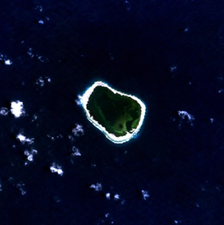
NASA astronaut image of Bassas da India Atoll in the Indian Ocean
Autor: Rosss, Licence: CC BY-SA 3.0
French language version of File:France-Constituent-Lands.png originally translated by User:Hypersite.

(c) ESA, CC BY-SA 3.0 igo
Suriname and French Guiana, located on the Atlantic Ocean in northern South America, are featured in this Envisat satellite image, which highlights the Maroni River (the large river seen on the right), the Suriname River (seen on the left) and the Brokopondo Reservoir (the dark blue area). Envisat acquired this image on 8 August 2006 with its Medium Resolution Imaging Spectrometer (MERIS) instrument while working in Full Resolution Mode to provide a spatial resolution of 300 metres.

Futuna and Alofi from space

Glorioso Islands

Landsat 7 image of Île aux Cochons, Crozet Islands, in the Southern Indian Ocean

Tromelin island. Satellite view.

Autor: NASA's Earth Observatory, Licence: CC BY 2.0
To download the full resolution and other files go to: earthobservatory.nasa.gov/IOTD/view.php?id=78218&src=...
In August 1768, Captain James Cook, naturalist Joseph Banks, and a shipload of sailors set sail from England to Tahiti to observe the Transit of Venus. Camped out on Point Venus, they witnessed the event on June 3, 1769. Cook sketched the transit, but Banks had surprisingly little to say about it. Perhaps he was distracted by the wonders of the island itself.
The Enhanced Thematic Mapper Plus on the Landsat 7 satellite captured this natural-color image of Tahiti on July 11, 2001. This island is part of a volcanic chain formed by the northwestward movement of the Pacific Plate over a fixed hotspot. Tahiti consists of two old volcanoes—Tahiti-Nui in the northwest and Tahiti-Iti in the southeast—linked by an isthmus.
Through studies of its rock layers, geologists have figured out the likely history of Tahiti-Nui. Today it is roughly round, and it was roughly round when it first formed as a volcanic shield between 1.4 million and 870,000 years ago. But between then and now, it had a different contour. Both the northern and southern flanks of Tahiti-Nui collapsed sometime around 860,000 years ago, gouging massive arcs out of the island’s perimeter. Soon after the northern flank collapse, a second shield volcano began forming. Volcanic material on the northern side of Tahiti-Nui eventually overtopped the original volcanic structure and started filling in the southern depression.
Although Tahiti-Nui now has a fairly symmetrical contour, it has an asymmetrical three-dimensional shape. Mountains are taller on the northern half of the island.
Yet something else besides volcanic activity has shaped Tahiti: rain. Heavy tropical rains have carved deep valleys, some with nearly vertical walls up to 1,000 meters (3,000 feet) tall. The angled sunlight in this image brightens some slopes, while leaving others in shadow. Tahiti’s sharp relief has complicated the geological surveys because they cause so much erosion. But the same rains have also promoted the growth of the lush plants that carpet both Tahiti-Nui and Tahiti-Iti.
Though the Transit of Venus was the stated objective of the British expedition, Banks was likely more interested in Tahiti’s plants. Specimens he collected from Tahiti, New Zealand, South America, Australia, and Java accounted for roughly 1,300 new species, and his famed collected is now stored at the Natural History Museum in London.
Complementing the rich life on land is marine life around Tahiti’s perimeter. Coral reefs fringe the island, and the reefs are thickest on the southern and western sides. Reefs frequently form along the submerged slopes of volcanic islands.
NASA Earth Observatory image by Jesse Allen and Robert Simmon, using Landsat data from the U.S. Geological Survey. Caption by Michon Scott.
The Earth Observatory's mission is to share with the public the images, stories, and discoveries about climate and the environment that emerge from NASA research, including its satellite missions, in-the-field research, and climate models.
Like us on Facebook
Follow us on Twitter
Add us to your circles on Google+Proposed flag for Réunion, created by the Vexillological Association of Réunion

NASA atronaut image of Juan de Nova Island, Indian Ocean

NASA Terra ASTER image of Amsterdam Island in the Southern Indian Ocean

Landsat 7 image of Saint-Paul Island in the Southern Indian Ocean

NASA Astronaut Image of Europa Island in the Indian Ocean

Crozetove ostrovy ( fra. Îles Crozet) je súostrovie vulkanického pôvodu, nachádzajúce sa v južnej časti Indického oceánu, patriace pod správu Francúzska, ako súčasť Francúzskych južných a antarktických území.
(c) I, Hoshie, CC BY 2.5
Local flag of Saint-Barthélemy, adopted 2007.
Autor: TUBS
Location of XY (see filename) in the world. See also List of countries spanning more than one continent

Saint Martin - NASA NLT Landsat 7 (Visible Color) Satellite Image
Autor: Jérôme, Licence: CC BY-SA 3.0
Coat of arms of Cayenne and of the French Guyana under a rectangular shape to be included in a flag-like template.

Drapeaux de la France et de la Nouvelle-Calédonie côte-à-côte.

.svg)
Unofficial local flag of Guadeloupe, from the xrmap flag collection 2.7. Original from FOTW

The Territorial Collectivity of Saint-Pierre and Miquelon is a self-governing overseas collectivity of France, off the southern coast of Newfoundland. It is the last remaining part of New France in North America to retain French sovereignty; its 6000 residents are French citizens. During the early part of its 500 year history, the island changed ownership numerous times between France and Britain. Only in 1816 were the islands permanently claimed by France, and French settlers came from Brittany, Normandy, and the Basque areas. The image was acquired September 27, 2011, covers an area of 25.5 by 45.6 km, and is located at 46.9 degrees north, 56.4 degrees west.
With its 14 spectral bands from the visible to the thermal infrared wavelength region and its high spatial resolution of about 50 to 300 feet (15 to 90 meters), ASTER images Earth to map and monitor the changing surface of our planet. ASTER is one of five Earth-observing instruments launched Dec. 18, 1999, on Terra. The instrument was built by Japan's Ministry of Economy, Trade and Industry. A joint U.S./Japan science team is responsible for validation and calibration of the instrument and data products.
The broad spectral coverage and high spectral resolution of ASTER provides scientists in numerous disciplines with critical information for surface mapping and monitoring of dynamic conditions and temporal change. Example applications are monitoring glacial advances and retreats; monitoring potentially active volcanoes; identifying crop stress; determining cloud morphology and physical properties; wetlands evaluation; thermal pollution monitoring; coral reef degradation; surface temperature mapping of soils and geology; and measuring surface heat balance.
The U.S. science team is located at NASA's Jet Propulsion Laboratory in Pasadena, Calif. The Terra mission is part of NASA's Science Mission Directorate, Washington.
More information about ASTER is available at http://asterweb.jpl.nasa.gov/.
Roughly 1,300 kilometers (830 miles) east of Australia lies Grande Terre, the largest island of New Caledonia. The island is roughly 400 kilometers (250 miles) long and ringed by a 1,600-kilometer (1,000-mile) coral reef.
Cloud-free skies allowed the Moderate Resolution Imaging Spectroradiometer (MODIS) on NASA’s Terra satellite a clear view of Grande Terre on September 24, 2012. Coral reefs, appearing iridescent blue-green through the seawater, surround the mostly vegetation-coated island.
New Caledonia has a hot and humid climate, but conditions vary between the coasts of Grande Terre. Trade winds from the southeast bring relatively cool, moist air to the eastern part of the island, where rich forests fill the coastal strip east of the mountains. In the west lie open, arid plains. Between the east and west coasts, a mountain range forms the island’s spine. The tallest point is Mont Panié with an elevation of 1,628 meters (5,341 feet) above sea level.
The British explorer James Cook gave New Caledonia its name because its mountains reminded him of Scotland (once named Caledonia). In the years since his expedition, geologists have teased New Caledonia’s history from clues in the rock record. New Caledona was once a part of Gondwana, an ancient supercontinent that broke apart tens of millions of years ago. New Caledonia drifted northeastward and finally settled in its current position about 50 million years ago. Between 45 and 33 million years ago, tectonic plates colliding with each other uplifted the region, including part of the sea floor. Once elevated, New Caledonia began to erode, thanks to the action of wind and water.
New Caledonia’s rocks are unusually rich in iron, magnesium, and nickel; in fact, the island is home to about a quarter of the world’s known nickel resources. Meanwhile the soils are poor in nitrogen, calcium, phosphorus, and potassium, and plant life has had to adapt. About 75 percent of New Caledonia’s plant species are found only the island, placing New Caledonia third, after Hawaii and New Zealand, for endemic plant species.
Marine life around New Caledonia rivals the unique plant life. The United Nations Educational, Scientific and Cultural Organization (UNESCO) characterizes the reef system as “the world’s most diverse concentration of reef structures.” The reef, mangrove, and seagrass habitats provide homes to fish, marine invertebrates, marine mammals (such as whales and dugongs), and turtles.