16-03-31-israelische Siedlungen bei Za'atara-WMA 1178

|
Dieses Foto ist von Ralf Roletschek Achtung: Dieses Bild ist nicht gemeinfrei. Es ist zwar frei benutzbar aber gesetzlich geschützt. |
This photo was created by Ralf Roletschek Note: this image is not in the Public Domain. It is free to use but protected by law. |
||
|
|
Entweder wird der Hinweis entsprechend den Lizenzbedingungen angegeben oder wie folgt: Ralf Roletschek / Roletschek.at in unmittelbarer Nähe beim Bild oder an einer Stelle in ihrer Publikation, wo dies üblich ist. Dabei muß der Zusammenhang zwischen Bild und Urhebernennung gewahrt bleiben. In jedem Fall sind Urheber und Lizenz zu nennen. Ein Link zu meiner Homepage ist erwünscht aber nicht Bedingung. |
Either the notice is given in accordance with the license conditions or as follows:: Ralf Roletschek / Roletschek.at near to the photo or at a location that is common in your publication but preserving the association between image and credit. In any event, copyright and license are to be mentioned.A link to my website is much appreciated but not mandatory. |
 |
|
Bitte lesen Sie den vollen Lizenztext gründlich, bevor Sie das Bild nutzen! Wenn Sie Fragen zu den Lizenzvereinbarungen haben oder weniger restriktive kommerzielle Lizenzen wünschen, kontaktieren Sie mich per Mail: ralf@roletschek.de |
Please review the full license requirements carefully before using this image. If you would like to clarify the terms of the license or negotiate less restrictive commercial licensing outside of the bounds of Licenses, please contact me by email: ralf@roletschek.de |
||


| Please do not upload a modified image here without consultation with the author. The author would like to make possible minor modifications only at his own source. (The source is usually a RAW file. Processing of the JPEG file means a loss of quality.) This ensures that the changes and the quality are preserved. If you think that any changes should be required, please contact the author. Otherwise you can upload a new image with a new name. Please use one of the templates Derivative or Extracted. Please enter your name too, if you upload a derivative or a detail, because you're in charge of the changes. Please do not rename this file. The name is part of the attribution. In the case of misstatements, the author is pleased to provide information. |
|
The making of this work was supported by Wikimedia Austria. For other files made with the support of Wikimedia Austria, please see the category Supported by Wikimedia Österreich. |


Relevantní obrázky


.jpg)


.JPG)

Relevantní články
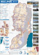
Západní břeh JordánuZápadní břeh Jordánu (též Předjordánsko, hebrejsky יהודה ושומרון, zastarale Jehuda ve-Šomron, nebo הגדה המערבית, ha-Gada ha-ma'aravit, arabsky الضفة الغربية, ad-Daffa al-gharbíja je označení pro vnitrozemské území na západním břehu řeky Jordán na Blízkém východě. Mezinárodním společenstvím je částečně uznáváno jako součást Palestinských území. .. pokračovat ve čtení
Izraelské osadyIzraelské osady jsou sídla založená Izraelem a Izraelci na územích, která židovský stát dobyl v šestidenní válce v roce 1967. Konkrétně jde o Východní Jeruzalém, Západní břeh Jordánu a Golanské výšiny, kde k roku 2021 žilo dohromady okolo 700 000 židovských osadníků. V minulosti existovaly izraelské osady i na Sinajském poloostrově a v Pásmu Gazy. .. pokračovat ve čtení