Austria.
Autor:
Shortlink:
Zdroj:
Formát:
4000 x 3272 Pixel (4900784 Bytes)
Popis:
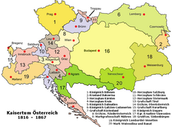
This rare hand colored map of Austria is a copper plate engraving dating to 1856. Produced by the important mid 19th century American map publisher J. H. Colton. Covers the Austria, Croatia-Slavonia, Hungary, the Czech Republic (Bohemia), Romania, Transylvania, and parts of Italy including Lombardy and Venice. Prepared out of Colton's 172 William St, New York, office for inclusion as plate no. 17 in the single volume 1856 issue of Colton's Atlas of the World . Colton initially issued his atlas by subscription in two separate volumes, one for North America (issued in 1855) and one for the rest of the world (issued in 1856). This map however, is from the rarer late 1856 issue of the full atlas in a single volume – Colton’s first complete world atlas. Thus, though the copyright is 1855, we can be assured that this map comes from the 1856 issue of the Atlas . This map would later become the prototype of all subsequent Johnson maps of Russia. Dated and copyrighted, Entered according to Act of Congress in the Year 1855 by J. H. Colton & Co. in the Clerk's Office of the District Court of the United States for the Southern District of New York.
Komentář k Licence:
|
Toto je věrná fotografická reprodukce původního dvourozměrného uměleckého díla. Ono dílo je samo volným dílem, a to z následujícího důvodu:
Oficiálním stanoviskem nadace Wikimedia Foundation je, že „věrné reprodukce dvourozměrných volných děl jsou také volné a opačná tvrzení jsou útokem na samotný koncept volných děl.“ Podrobnosti naleznete na stránce Commons:When to use the PD-Art tag.
Tato fotografická reprodukce se tedy také považuje za volné dílo. Uvědomte si, že v závislosti na místních zákonech může být další užití tohoto díla ve vaší jurisdikci zakázáno či omezeno. Vizte Commons:Reuse of PD-Art photographs. | ||||
Licence:
Public domain
Credit:
This file was provided to Wikimedia Commons by Geographicus Rare Antique Maps, a specialist dealer in rare maps and other cartography of the 15th, 16th, 17th, 18th and 19th centuries, as part of a cooperation project.
Relevantní obrázky
Relevantní články
Rakouské císařstvíRakouské císařství byl poloúřední název užívaný v období od 11. srpna 1804 do 21. prosince 1867 pro souhrn dědičných zemí pod vládou rodu habsbursko-lotrinského. .. pokračovat ve čtení


