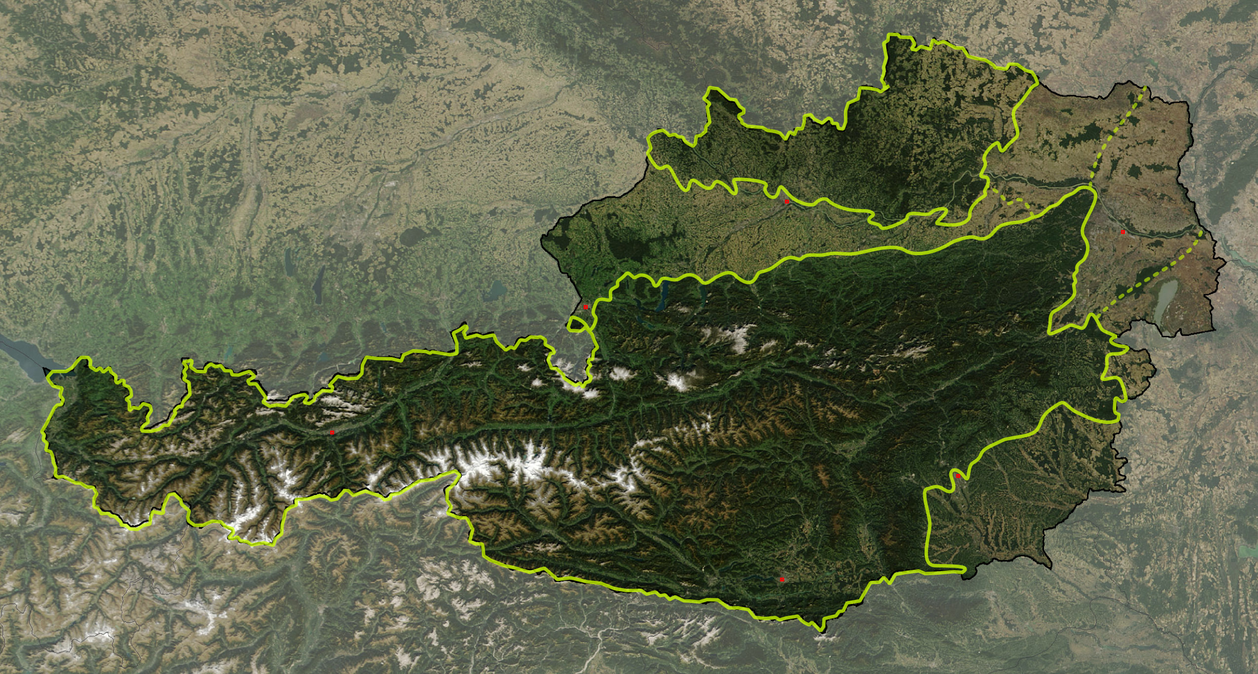
Austria satellite Grosslandschaften markerstyle
Autor:
Shortlink:
Zdroj:
Formát:
2457 x 1318 Pixel (6403185 Bytes)
Popis:
Satellite image of Austria with greater landscapes: Austrian Alps, Alpine Forelands and Rim Basins, Granite and Gneiss Highlands
Komentář k Licence:
Based on a NASA image, thus in the public domain.
Licence:
Public domain
Credit:
The image is based on a satellite image from [1]. Original image: Credit Jeff Schmaltz, MODIS Rapid Response Team, NASA/GSFC. It was cropped and reduced in contrast around Austria by Michael Schmid, which is Image:Austria satellite unannotated.jpg. Borderlines added with Inkscape.
Sdílet obrázek:


Relevantní obrázky


![[1]](http://visibleearth.nasa.gov/images/5947/Italy.A2003262.1005.250m.jpg)
Relevantní články
Geografie RakouskaTento článek popisuje geografické poměry v Rakousku. .. pokračovat ve čtení