AxelHeibergIslandCloseupMap
Autor:
Shortlink:
Zdroj:
Formát:
499 x 449 Pixel (13696 Bytes)
Popis:
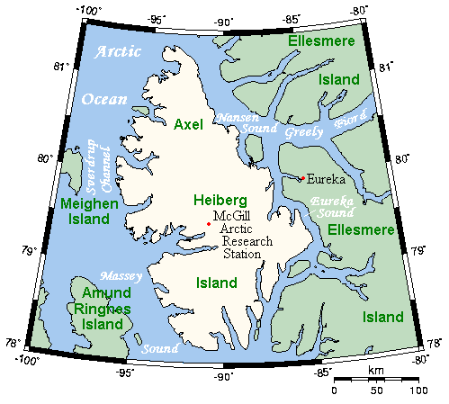
A map of Axel Heiberg Island, Nunavut, Canada, and surrounding islands and waterways.
Licence:
Credit:
This map's source is here, with the uploader's modifications, and the GMT homepage says that the tools are released under the GNU General Public License.
Sdílet obrázek:


Relevantní obrázky


.svg)
Relevantní články
Ostrov Axela HeibergaOstrov Axela Heiberga se nachází v nejmladším a největším teritoriu Kanady v Nunavutu, na severovýchodě Kanadského arktického souostroví, v nejsevernější oblasti Severní Ameriky. .. pokračovat ve čtení