Camp Fire oli 2018312 Landsat
Autor:
NASA, Joshua Stevens
Shortlink:
Zdroj:
Formát:
3017 x 2011 Pixel (1343212 Bytes)
Popis:
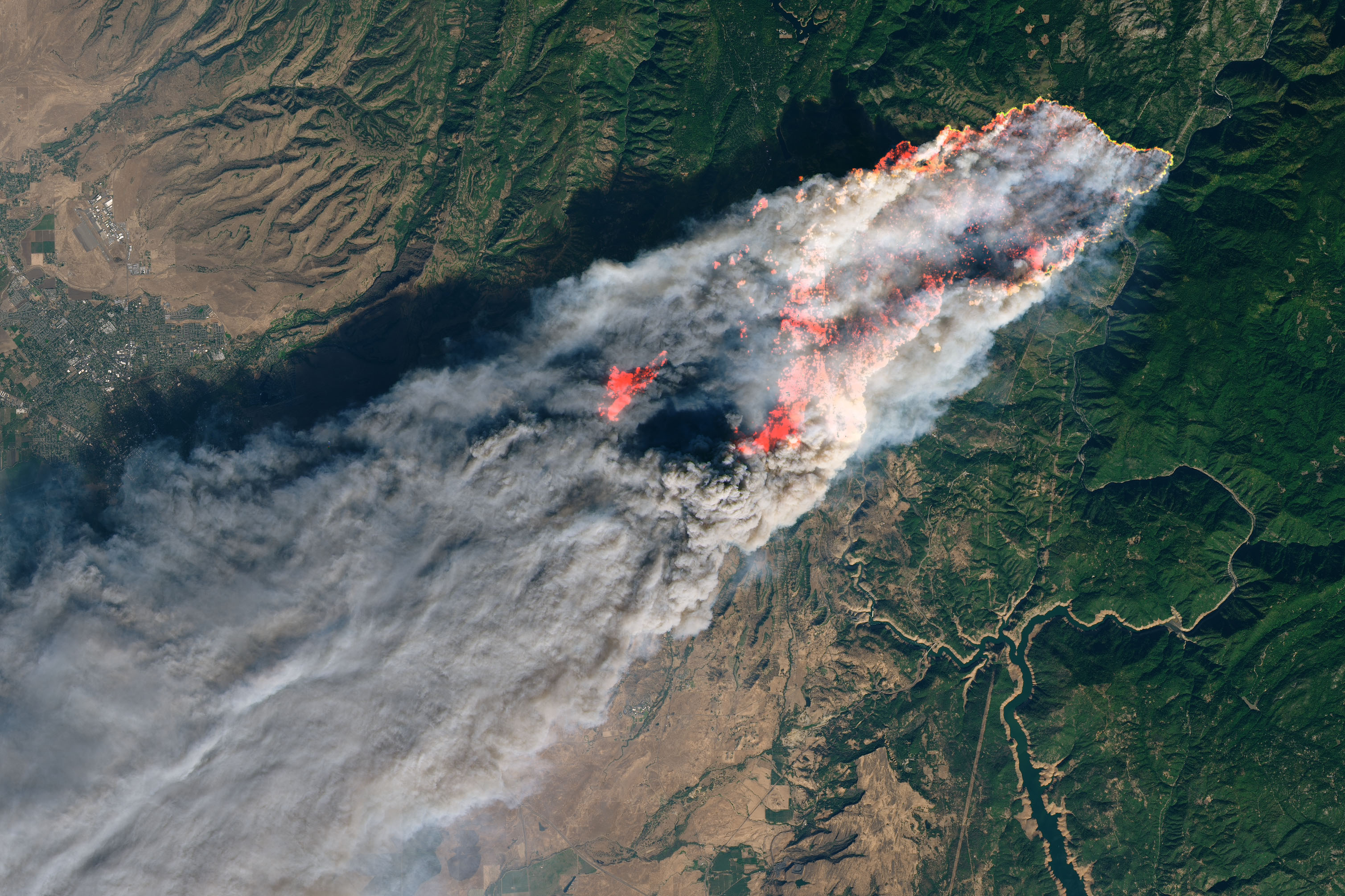
On the morning of November 8, 2018, the Camp Fire erupted 90 miles (140 kilometers) north of Sacramento, California. By evening, the fast-moving fire had charred around 18,000 acres and remained zero percent contained, according to news reports.
The Operational Land Imager on Landsat 8 acquired this image on November 8, 2018, around 10:45 a.m. local time (06:45 Universal Time). The natural-color image was created using bands 4-3-2, along with shortwave infrared light to highlight the active fire.
Officials evacuated several towns, including Paradise. They also closed several major highways.
Licence:
Public domain
Sdílet obrázek:


Relevantní obrázky


.jpg)

.svg)


