ChiosPrefecture
Autor:
Fotografie: NASA
Shortlink:
Zdroj:
Formát:
1278 x 927 Pixel (111297 Bytes)
Popis:
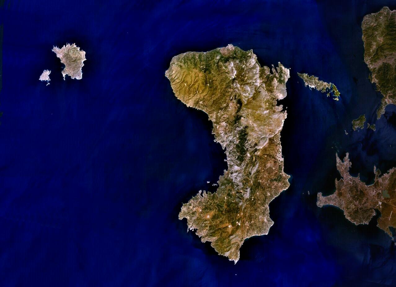
Public Domain composite satellite image of Chios Prefecture; consisting of the islands of Chios (centre), of Psara and Anti-Psara (West and far west), the Oinousses islands (East of Chios). Also includes Turkish mainland (East-shaded).
This work was previously under Public Domain. It has been digitally enhanced and/or modified. This derivative work has been (or is hereby) released into the public domain by its author, User:AlekH. This applies worldwide.
Source: NASA World Wind.
In some countries this is not legally possible; if so:
Licence:
Public domain
Credit:
Satellite imagery taken from NASA World Wind software (by screenshot)
Sdílet obrázek:


Relevantní obrázky


Relevantní články
Chios (regionální jednotka)Chios je jednou z 5 regionálních jednotek kraje Severní Egeis v Řecku. Zahrnuje území obydlených ostrovů Chios, Oinousses a Psara a menších okolních neobydlených ostrovů. Hlavním městem je Chios. Břehy omývá Egejské moře. .. pokračovat ve čtení