Debris-LEO1280
Autor:
NASA employee
Shortlink:
Zdroj:
Formát:
1280 x 1280 Pixel (264120 Bytes)
Popis:
debris plot by NASA
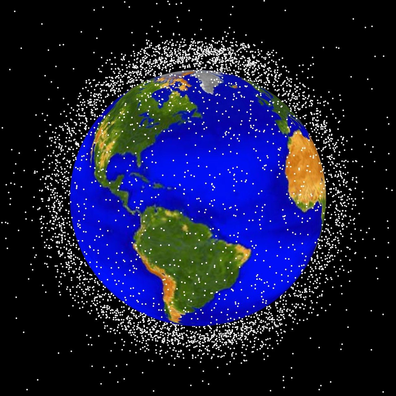
The following graphics are computer generated images of objects in Earth orbit that are currently being tracked. Approximately 95% of the objects in this illustration are orbital debris, i.e., not functional satellites. The dots represent the current location of each item. The orbital debris dots are scaled according to the image size of the graphic to optimize their visibility and are not scaled to Earth. These images provide a good visualization of where the greatest orbital debris populations exist. Below are the graphics generated from different observation points. LEO stands for low Earth orbit and is the region of space within 2,000 km of the Earth's surface. It is the most concentrated area for orbital debris.
The following graphics are computer generated images of objects in Earth orbit that are currently being tracked. Approximately 95% of the objects in this illustration are orbital debris, i.e., not functional satellites. The dots represent the current location of each item. The orbital debris dots are scaled according to the image size of the graphic to optimize their visibility and are not scaled to Earth. These images provide a good visualization of where the greatest orbital debris populations exist. Below are the graphics generated from different observation points. LEO stands for low Earth orbit and is the region of space within 2,000 km of the Earth's surface. It is the most concentrated area for orbital debris.
Licence:
Public domain
Sdílet obrázek:


Relevantní obrázky


Relevantní články
Kosmické smetíKosmické smetí je označení pro tisíce úlomků, nefunkčních družic a dalších těles, vypuštěných do vesmíru lidmi. Větší část jich létá kolem Země a stávají se svým množstvím a hustotou hrozbou pro nově vypouštěné družice a lodě s kosmonauty. .. pokračovat ve čtení