Dorian 2019 track
Autor:
Shortlink:
Zdroj:
Formát:
2700 x 2700 Pixel (3753632 Bytes)
Popis:
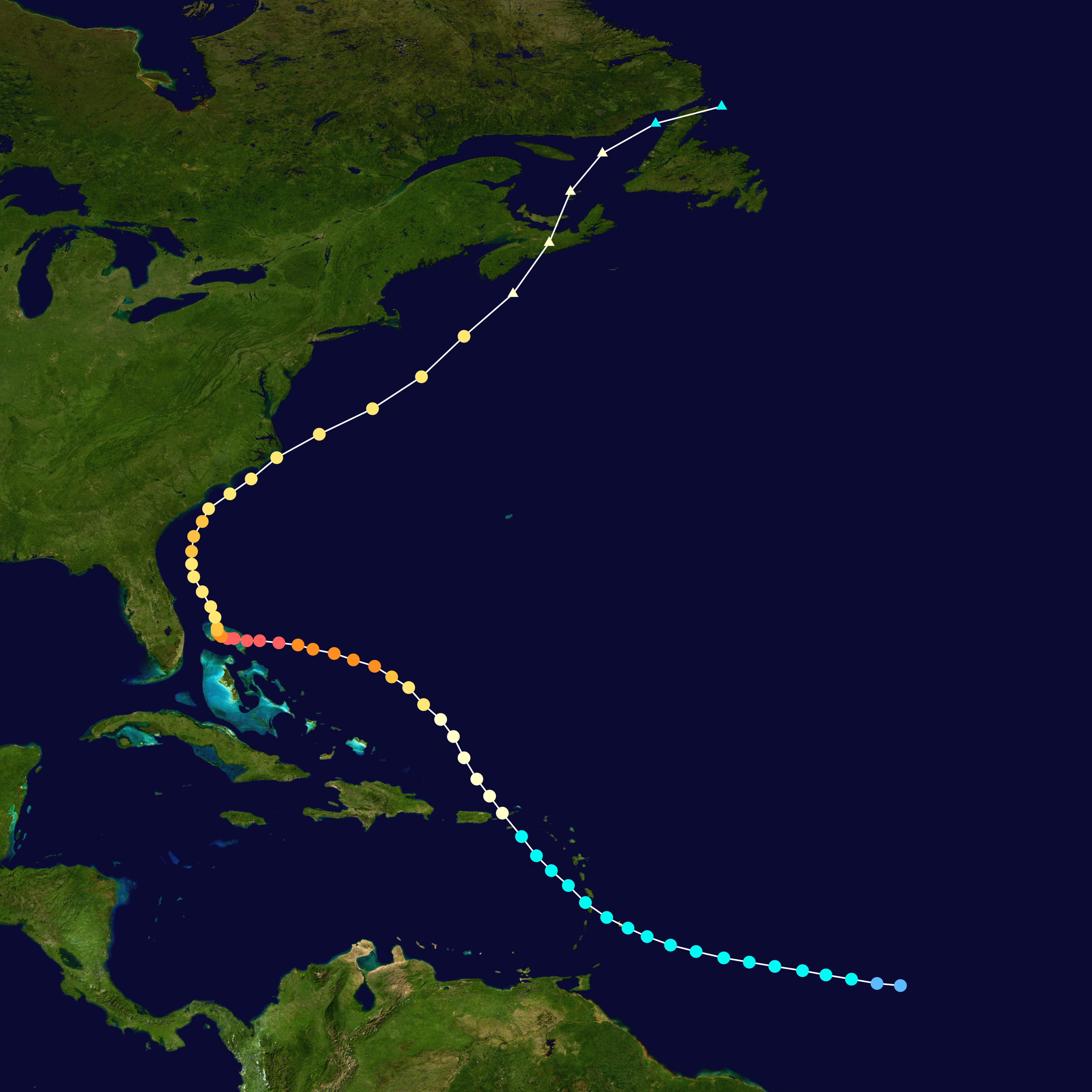
Track map of Hurricane Dorian of the 2019 Atlantic hurricane season. The points show the location of the storm at 6-hour intervals. The colour represents the storm's maximum sustained wind speeds as classified in the (see below), and the shape of the data points represent the nature of the storm, according to the legend below.
 Extratropical cyclone / Remnant low / Tropical disturbance / Monsoon depression
Tropical depression (≤38 mph, ≤62 km/h)
Tropical storm (39–73 mph, 63–118 km/h)
Category 1 (74–95 mph, 119–153 km/h)
Category 2 (96–110 mph, 154–177 km/h)
Category 3 (111–129 mph, 178–208 km/h)
Category 4 (130–156 mph, 209–251 km/h)
Category 5 (≥157 mph, ≥252 km/h)
Unknown
Storm type
Licence:
Public domain
Credit:
Created by FleurDeOdile using Wikipedia:WikiProject Tropical cyclones/Tracks. The background image is from NASA. Tracking data is from the National Hurricane Center[1].
Sdílet obrázek:


Relevantní obrázky


Relevantní články
Hurikán DorianHurikán Dorian byla silná tropická cyklóna, která na přelomu srpna a září 2019 prošla západním Atlantským oceánem. Šlo o čtvrtou pojmenovanou tropickou bouři a druhý hurikán atlantické hurikánové sezóny 2019. Dorian způsobil katastrofické škody na severních Bahamách, kde za sebou zanechal přes 50 mrtvých, dalších 1300 osob je zde stále vedeno jako nezvěstných. .. pokračovat ve čtení