EB 1911 Map Fig 3
Autor:
Anonymous. Presumably Emery Walker.
Shortlink:
Zdroj:
Formát:
1072 x 1064 Pixel (835446 Bytes)
Popis:
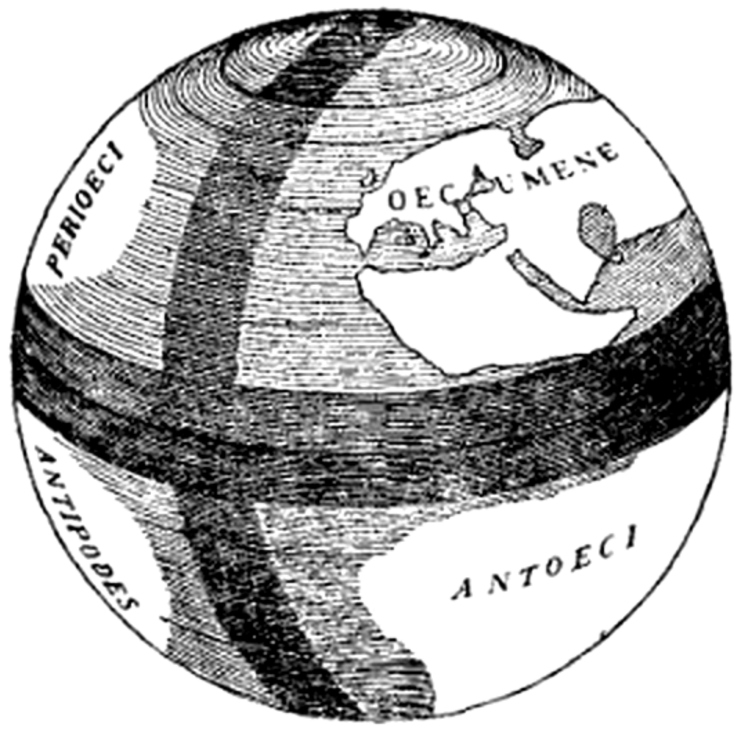
Caption: "Fig. 2.—The Globe of Crates of Mallus."
An illustration of the globe demonstrated by Crates in Rome, displaying the oecumene (the known world of Europe, Asia, and Cissaharan Africa), perioeci (the unknown land hypothesized to lie on the other side of the Northern Hemisphere), antoeci (the unknown land hypothesized to lie on the other side of the equator, inaccessible owing to the presumed impossible heat), and antipodes (the unknown land hypothesized to lie on the opposite side of the world, likewise inaccessible).
The caption describes it as "Fig. 2", but it is actually the third figure in the article.
Licence:
Public domain
Credit:
"Map" in the Encyclopaedia Britannica, 11th ed., Vol. XVII, p. 635.
Sdílet obrázek:


Relevantní obrázky


Relevantní články
GlóbusGlóbus je v kartografii zmenšené prostorové, nejčastěji kulové, znázornění určitého vesmírného tělesa pomocí kartografických prostředků. Mezi nejčastější patří glóby zemského tělesa a nebeské sféry. .. pokračovat ve čtení