France population density 40pc

Autor:
Přisuzování:
Obrázek je označen jako „Vyžadováno uvedení zdroje“ (Attribution Required), ale nebyly uvedeny žádné informace o přiřazení. Při použití šablony MediaWiki pro licence CC-BY byl pravděpodobně parametr atribuce vynechán. Autoři zde mohou najít příklad pro správné použití šablon.
Shortlink:
Zdroj:
Formát:
1246 x 2018 Pixel (549954 Bytes)
Popis:
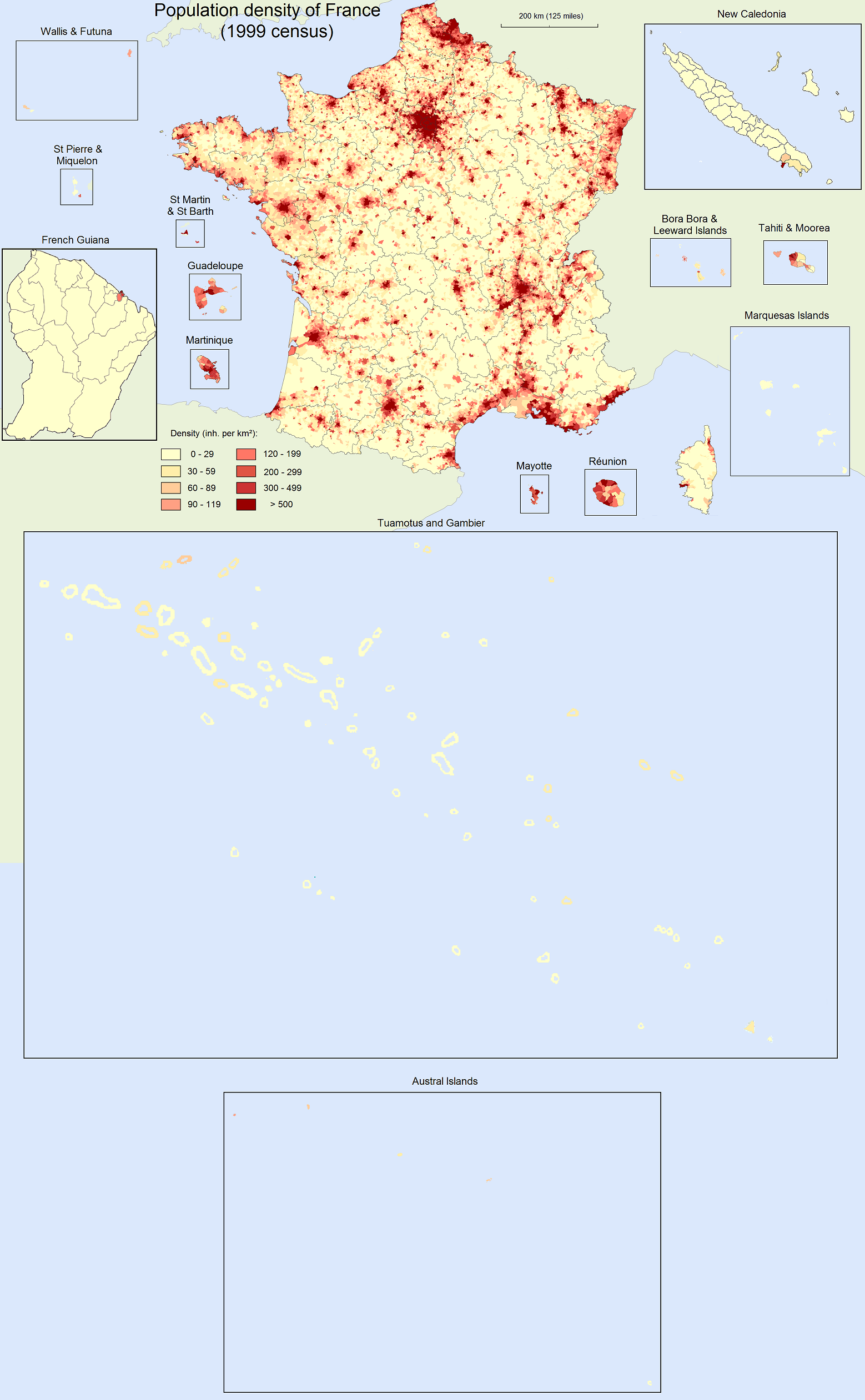
Population density map of France (40% of original). For the original (more detailed) version of the map, see: France_population_density.png.
Density is as of 1999 census for Metropolitan France, Réunion, French Guiana, Martinique, Guadeloupe, St Martin & St Barth, and St Pierre & Miquelon. Density is as of 2002 census for Mayotte, Tahiti & Moorea, Bora Bora & Leeward Islands, Marquesas Islands, Tuamotus & Gambier, and Austral Islands. Density is as of 2003 census for Wallis & Futuna. Density is as of 2004 census for New Caledonia.
Density is as of 1999 census for Metropolitan France, Réunion, French Guiana, Martinique, Guadeloupe, St Martin & St Barth, and St Pierre & Miquelon. Density is as of 2002 census for Mayotte, Tahiti & Moorea, Bora Bora & Leeward Islands, Marquesas Islands, Tuamotus & Gambier, and Austral Islands. Density is as of 2003 census for Wallis & Futuna. Density is as of 2004 census for New Caledonia.
Licence:
Credit:
Vlastní dílo
Sdílet obrázek:


Relevantní obrázky

Relevantní články
Obyvatelstvo FranciePočet obyvatel Francie v roce 2017 činil 65 071 155 včetně zámořských teritorií. .. pokračovat ve čtení