Franz Josef Land, Aug 2011
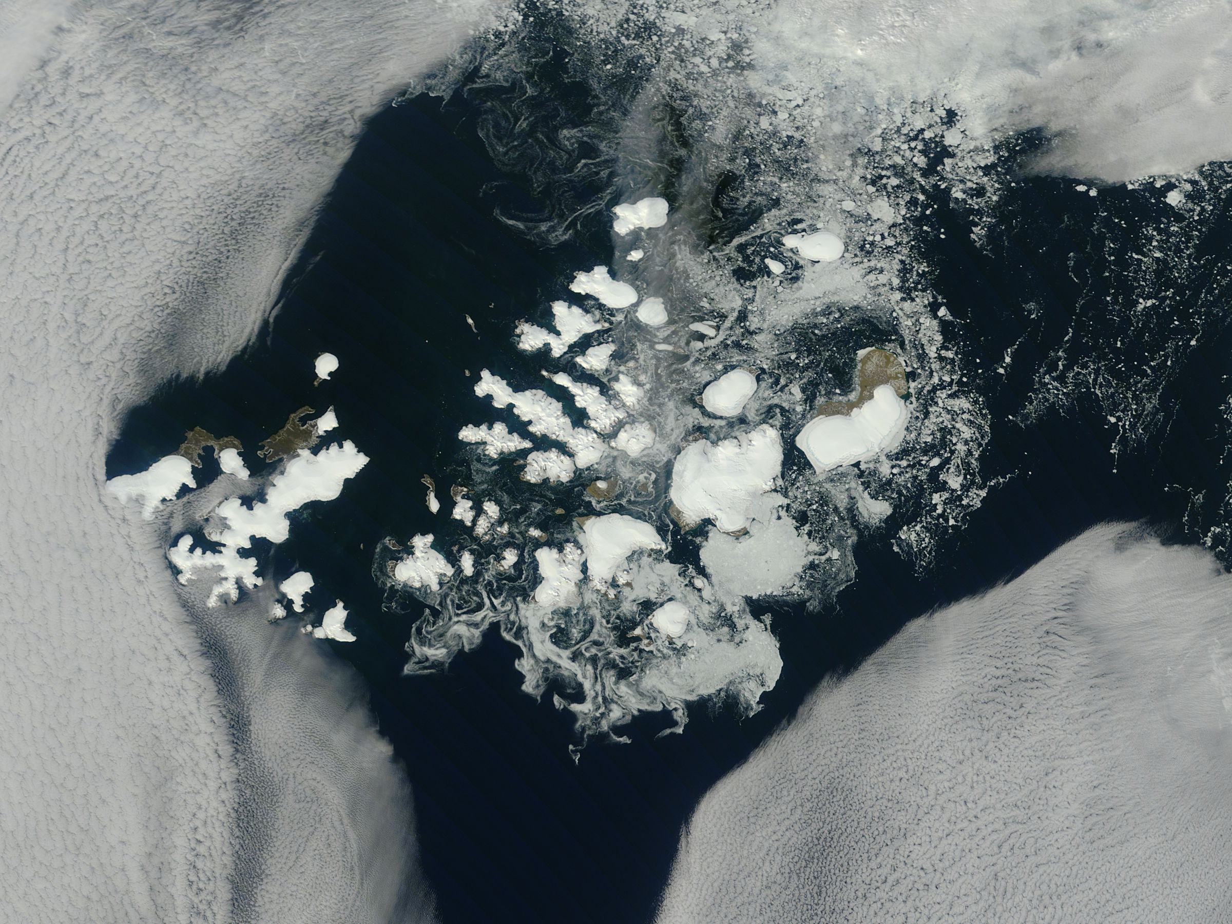
NASA image captured this true-color image on August 14, 2011
The clouds parted over the northeast Barents Sea region of the Arctic Ocean in late summer allowing a view of the ice-covered islands of Franz Josef Land (Russia) forming a stark-white contrast to the surrounding dark sea water. The Moderate Resolution Imaging Spectroradiometer (MODIS) aboard the Terra satellite captured this true-color image on August 14, 2011.
Franz Josef Land is an archipelago of 6 main islands and about 135 small islands, with a total landmass of about 16,134 square kilometers (6,229 square miles). The terrain is primarily elevated table lands and low hills, with the highest point rising to 620 m (2034 feet).
The glaciers on the islands of Franz Josef are currently in a state of retreat, and in this image large areas of the main islands clearly appear ice free. However, up to 85% of the island’s landmass is permanently ice-covered, with an average ice thickness of about 180 m (590 feet). On Graham Bell Island —the large island on the eastern edge of the group— the Windy Dome Ice Cap reaches a depth of greater than 500 m (1,640 feet). Although being late summer, sea ice can still be seen surrounding many of the islands.
Credit: NASA/GSFC/Jeff Schmaltz/MODIS Land Rapid Response Team
NASA Goddard Space Flight Center enables NASA’s mission through four scientific endeavors: Earth Science, Heliophysics, Solar System Exploration, and Astrophysics. Goddard plays a leading role in NASA’s accomplishments by contributing compelling scientific knowledge to advance the Agency’s mission.
Follow us on Twitter
Like us on Facebook
Find us on InstagramFranz Josef Land, Arctic Ocean
- Uploaded by PDTillman


Relevantní obrázky


Relevantní články
Země Františka JosefaZemě Františka Josefa je souostroví v Severním ledovém oceánu, na severním okraji Barentsova moře. Jde o nejsevernější část Evropy – Fligelyho mys na Rudolfově ostrově se nachází na 81° 51′ s. š.. Souostroví není trvale obydleno. .. pokračovat ve čtení