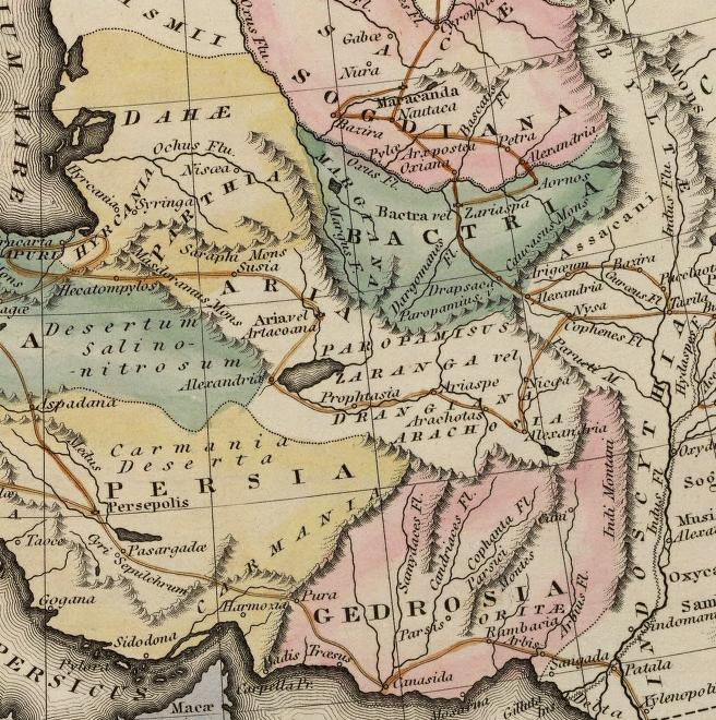
Gedrosia-Map-Route-of-Alexander-1823-Lucas
Autor:
Shortlink:
Zdroj:
Formát:
656 x 660 Pixel (901980 Bytes)
Popis:
Map of the route of Alexander the Great in South Asia,
- expedition through through Gedrosia, Bactria, and Sogdiana
- part of a map entitled "Alexandri Magni Itinera" based upon Melish (1815) Atlas of Ancient Geography
Licence:
Public domain
Credit:
scanned from Plate 12 of A general atlas containing distinct maps of all the known countries in the world by Fielding Lucas
Sdílet obrázek:


Relevantní články
GedrósieGedrósie je historická oblast, které dnes přibližně odpovídá Balúčistán v Pákistánu, její jižní hranici tvoří Ománský záliv. V roce 325 př. n. l. přes Gedrósii táhl Alexandr Makedonský se svými vojsky na cestě zpět do Babylónu. Po roce 302 př. n. l. připadla Čandraguptovi Maurjovi z dynastie Maurjů, který ji tak vytrhl z područí Seleuka I. Níkátóra. .. pokračovat ve čtení