Germany occupation zones with border
Autor:
US Army
Shortlink:
Zdroj:
Formát:
1460 x 1212 Pixel (882030 Bytes)
Popis:
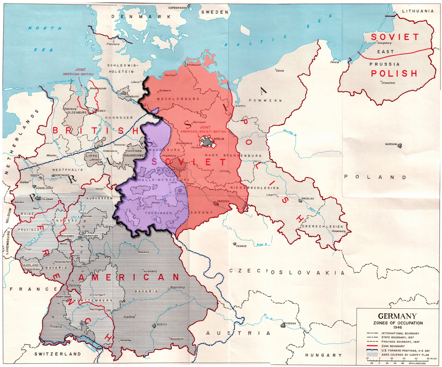
Map of the occupation zones of Germany in 1945, modified to show the inner German border and the zone from which Allied forces withdrew in July 1945. From Earl F. Ziemke, The U.S. Army in the Occupation of Germany, 1975. Library of Congress, Catalog Card Number 75-619027.
Licence:
Public domain
Credit:
Sdílet obrázek:


Relevantní obrázky

Relevantní články
Vnitroněmecká státní hraniceVnitroněmecká hranice bylo označení státní hranice mezi Německou demokratickou republikou a Německou spolkovou republikou v letech 1949 až 1990. Označení nezahrnovalo hranici mezi Západním Berlínem a Německou demokratickou republikou, kde byla postavena Berlínská zeď. .. pokračovat ve čtení