Great Wall of China, Satellite image
Autor:
NASA/GSFC/MITI/ERSDAC/JAROS and U.S./Japan ASTER Science Team
Shortlink:
Zdroj:
Formát:
800 x 800 Pixel (229656 Bytes)
Popis:
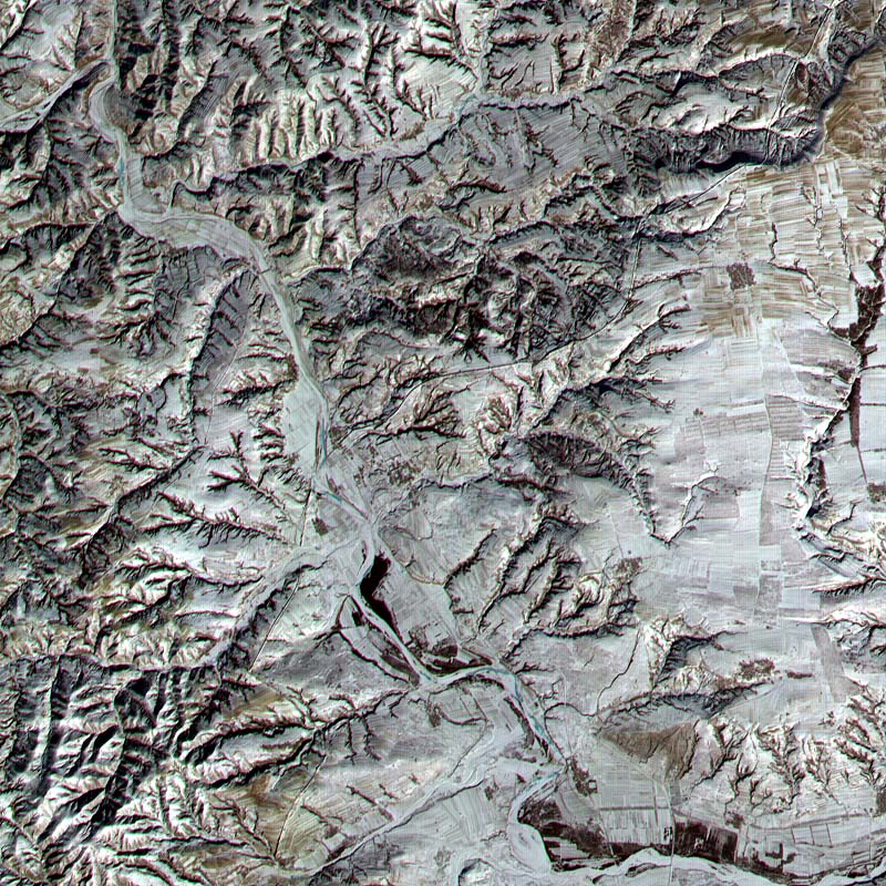
A satellite image of the Great Wall of China.
This Advanced Spaceborne Thermal Emission and Reflection Radiometer (ASTER) sub-image covers a 12 × 12 km (7.5 × 7.5 miles) area in Northern Shanxi Province, China, and was acquired January 9, 2001. The low sun angle and light snow cover highlight a section of the Great Wall, visible as a black line running diagonally through the image from lower left to upper right. The Great Wall is more than 2000 years old and was built over a period of 1000 years. Stretching 7240 km (4500 miles) from Korea to the Gobi Desert, it was first built to protect China from marauders from the north.
Komentář k Licence:
| This file is in the public domain in the United States because it was solely created by NASA. NASA copyright policy states that "NASA material is not protected by copyright unless noted". (See Template:PD-USGov, NASA copyright policy page or JPL Image Use Policy.) | ||
 |
Warnings:
|
Licence:
Public domain
Credit:
Sdílet obrázek:


Relevantní obrázky
.svg)


Relevantní články
Šan-siŠan-si je provincie na severu Čínské lidové republiky. .. pokračovat ve čtení