Greater Croatia 01
Autor:
Dr.Gonzo na projektu Wikipedie v jazyce angličtina
Shortlink:
Zdroj:
Formát:
1151 x 1041 Pixel (156832 Bytes)
Popis:
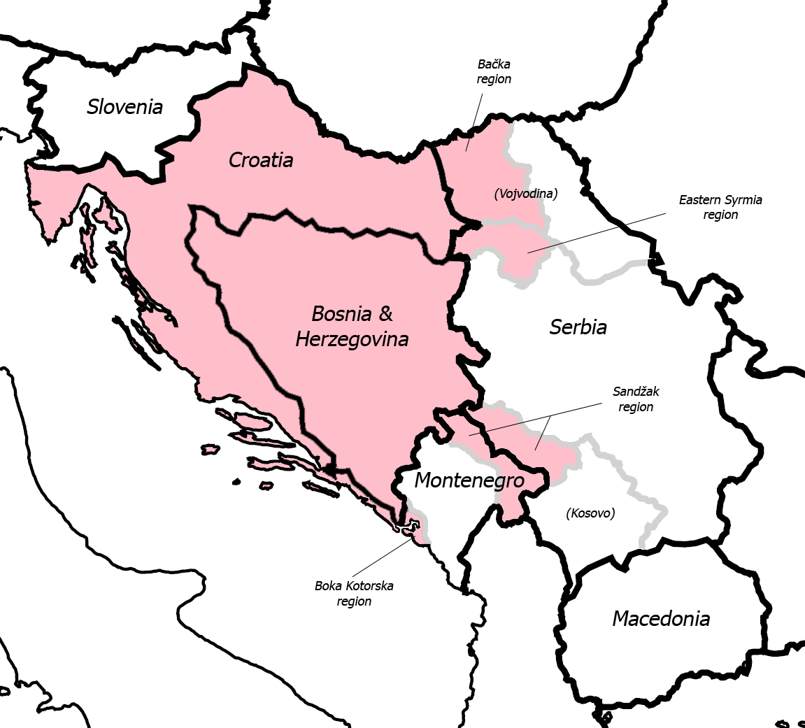
Fixed some detail, used overlaid Sandzak, Backa & Syrmium regions so it's much more accurate now. Pink coloring denotes regions claimed by Greater Croatian proponents. Current country borders are black, regional borders (only those that are relevant to the article) are grey.
Comment
Map is still wrong:) Croatian-Slovenian border in Istria is 20 kilometars southern that it should be (Umag and Savudrija are in Croatia, hej!) And borders of eastern Srijem are not correct (Zemun and Novi Beograd are part of Srijem, too).
- I fixed the Istria issue, but keep in mind that this map is just a general illustration of the point in question, nothing more. Also, I don't think Belgrade region was ever claimed as a part of Greater Croatia (although anything is possible I guess) so I left it out. --Dr.Gonzo 10:52, 13 March 2007 (UTC)
Licence:
Public domain
Credit:
Na Commons přeneseno z en.wikipedia.
Sdílet obrázek:


Relevantní obrázky


Relevantní články
Velké ChorvatskoVelké Chorvatsko je myšlenkový koncept rozšíření chorvatského území i na některé další oblasti v regionu, především východním směrem, na úkor Bosny a Hercegoviny, Srbska a Černé Hory. .. pokračovat ve čtení