Gunung Klabat
Autor:
S. Wikartadipura (Volcanological Survey of Indonesia)
Shortlink:
Zdroj:
Formát:
640 x 428 Pixel (52856 Bytes)
Popis:
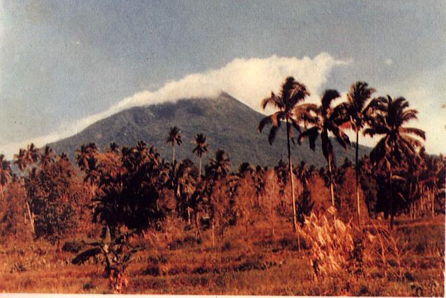
Weather clouds drape the summit of Gunung Klabat, an isolated symmetrical stratovolcano that rises to 1995 m near the eastern tip of the northern arm of Sulawesi. Klabat, rising above the farming village of Tatelu below its NW flank, has a shallow lake in its 170 x 250 m summit crater. No verified historical eruptions have occurred from Klabat volcano, the highest peak in northern Sulawesi.
Komentář k Licence:
| This file is in the public domain in Indonesia, because it is published and distributed by the Government of Republic of Indonesia, according to Article 43 of Law 28 of 2014 on copyrights.
There shall be no infringement of Copyright for:
|
 |
Licence:
Public domain
Sdílet obrázek:


Relevantní obrázky


Relevantní články
KlabatKlabat je dlouhodobě nečinná sopka, nacházející se na prodlouženém konci severního ramene indonéského ostrova Celebes, asi 20 km východně od města Manadao. S výškou 1 995 m je to nejvyšší bod ostrova. Vrchol hory je ukončený kráterem s rozměry 170 × 250 m, v němž se rozkládá kráterové jezero s velmi čistou vodou. Kdy došlo k poslední erupci, není známo. Jediným projevem aktivity jsou fumaroly. Klabat je turisticky vyhledávaným cílem, nicméně celková cesta může zabrat až 8 hodin. .. pokračovat ve čtení