Hurricane Katrina August 28 2005 NASA
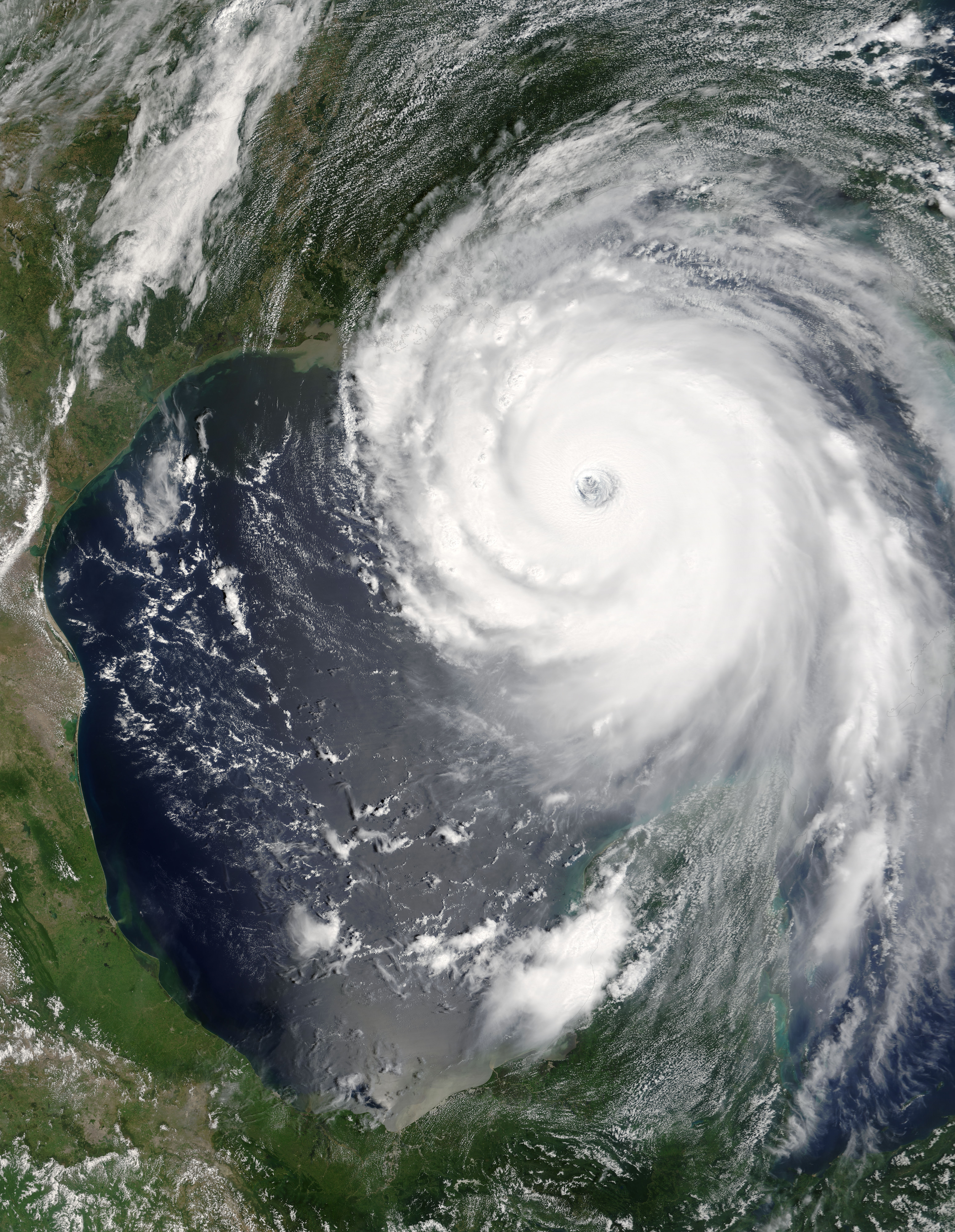
“Katrina is comparable in intensity to Hurricane Camille of 1969, only larger,” warned the National Hurricane Center on Sunday, August 28, 2005. By this time, Hurricane Katrina was set to become one of the most powerful storms to strike the United States, with winds of 257 kilometers per hour (160 miles per hour) and stronger gusts. The air pressure, another indicator of hurricane strength, at the center of this Category 5 storm measured 902 millibars, the fourth lowest air pressure on record for an Atlantic storm. The lower the air pressure, the more powerful the storm.
Two hours after the National Hurricane Center issued their warning, the Moderate Resolution Imaging Spectroradiometer (MODIS) captured this image from NASA’s Terra satellite at 1:00 p.m. Eastern Daylight Savings Time. The massive storm covers much of the Gulf of Mexico, spanning from the U.S. coast to the Yucatan Peninsula.| This file is in the public domain in the United States because it was solely created by NASA. NASA copyright policy states that "NASA material is not protected by copyright unless noted". (See Template:PD-USGov, NASA copyright policy page or JPL Image Use Policy.) |
|
|
 |
Warnings:
|


Relevantní obrázky


Relevantní články
Hurikán KatrinaKatrina je jméno hurikánu, který na konci srpna 2005 způsobil obrovské škody na jihu Spojených států. Rychlost větru dosahovala na moři až 280 km/h, na pevnině kolem 250 km/h. U New Orleansu se protrhly ochranné hráze a město zcela zaplavila voda z oceánu a blízkého jezera Pontchartrain. Z ekonomického hlediska jde patrně o vůbec největší katastrofu způsobenou atlantickým hurikánem.[zdroj?] .. pokračovat ve čtení