Ike 2008 track
Autor:
Shortlink:
Zdroj:
Formát:
2700 x 1669 Pixel (2518080 Bytes)
Popis:
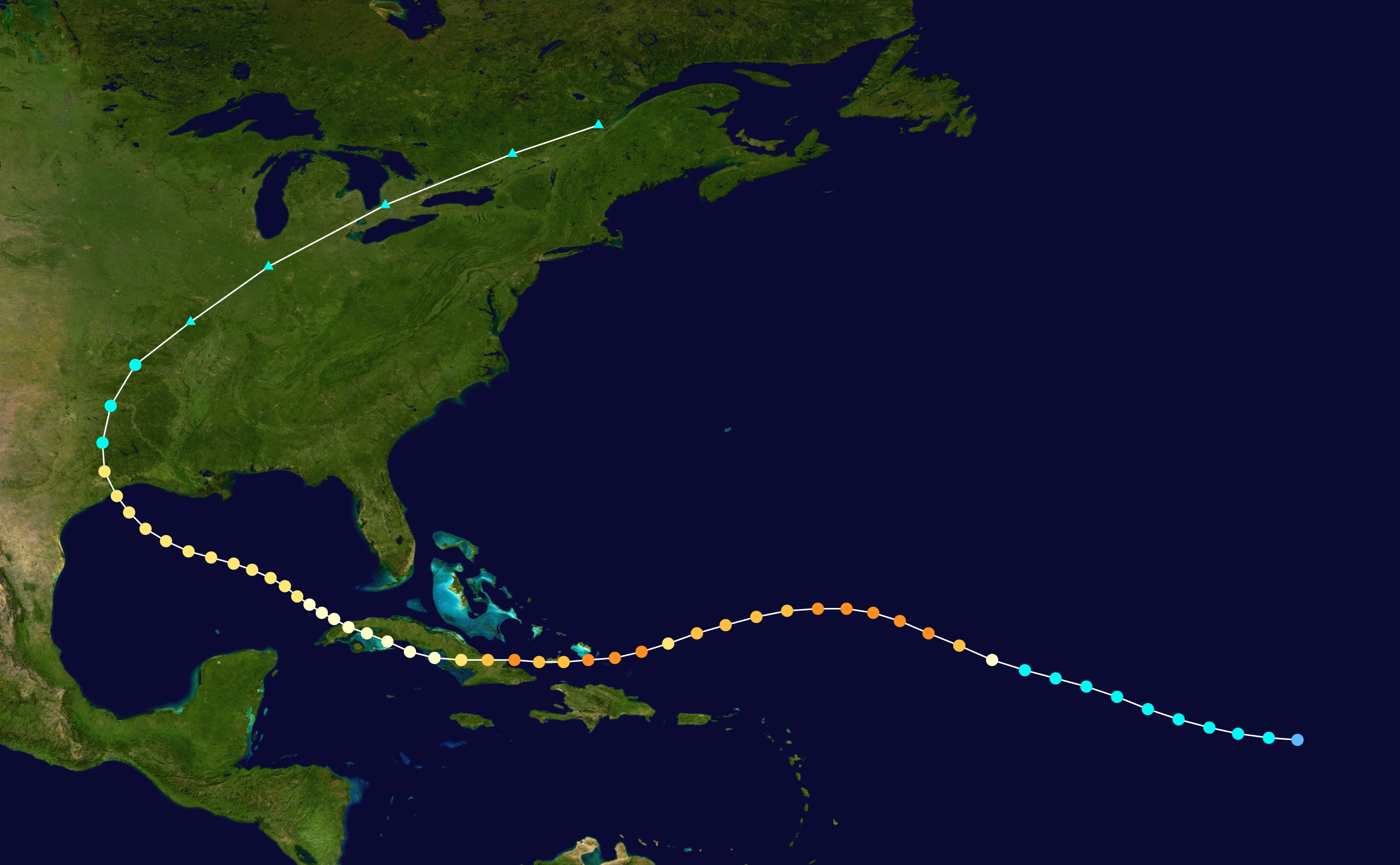
Track map of Hurricane Ike of the 2008 Atlantic hurricane season. The points show the location of the storm at 6-hour intervals. The colour represents the storm's maximum sustained wind speeds as classified in the Saffir–Simpson scale (see below), and the shape of the data points represent the nature of the storm, according to the legend below.
 Extratropical cyclone / Remnant low / Tropical disturbance / Monsoon depression
Tropical depression (≤38 mph, ≤62 km/h)
Tropical storm (39–73 mph, 63–118 km/h)
Category 1 (74–95 mph, 119–153 km/h)
Category 2 (96–110 mph, 154–177 km/h)
Category 3 (111–129 mph, 178–208 km/h)
Category 4 (130–156 mph, 209–251 km/h)
Category 5 (≥157 mph, ≥252 km/h)
Unknown
Storm type
Licence:
Public domain
Credit:
Created by Supportstorm using WikiProject Tropical cyclones/Tracks. The background image is from NASA. Tracking data is from the National Hurricane Center[1].
Sdílet obrázek:


Relevantní obrázky


Relevantní články
Hurikán IkeHurikán Ike byl devátou pojmenovanou tropickou cyklónou, pátým hurikánem a třetím velkým hurikánem v sezóně 2008. .. pokračovat ve čtení