Inland Niger Delta 2007
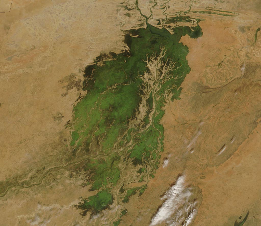
The MODIS on the Terra satellite took this picture of the Inland Niger Delta on November 11, 2007 shortly after the end of the rainy season when the landscape remained lush and green. This inland delta is a complex combination of river channels, lakes, swamps, and occasional areas of higher elevation. One such area of higher elevation is obvious in this image, and it forms a branching shape, like a tan tree pushing up toward the north.
This wet oasis in the African Sahel provides habitat both for migrating birds and West African manatees. The fertile floodplains also provide much needed resources for the local people, who use the area for fishing, grazing livestock, and cultivating rice.


Relevantní obrázky

Relevantní články
Vnitrozemská delta NigeruVnitrozemská delta Nigeru nebo také Macina je oblast v republice Mali mezi městy Djenné a Timbuktu, která má rozlohu okolo 64 000 km² a žije v ní přes půl milionu lidí. Veletok Niger zde přijímá zprava přítok Bani a rozlévá se v ploché krajině do šíře, vytváří tak množství mokřadů, ramen a jezírek. Bohatě zavodněná krajina kontrastuje s okolním vyprahlým Sahelem. .. pokračovat ve čtení