ItalianMareNostrum
Autor:
Shortlink:
Zdroj:
Formát:
1254 x 630 Pixel (326397 Bytes)
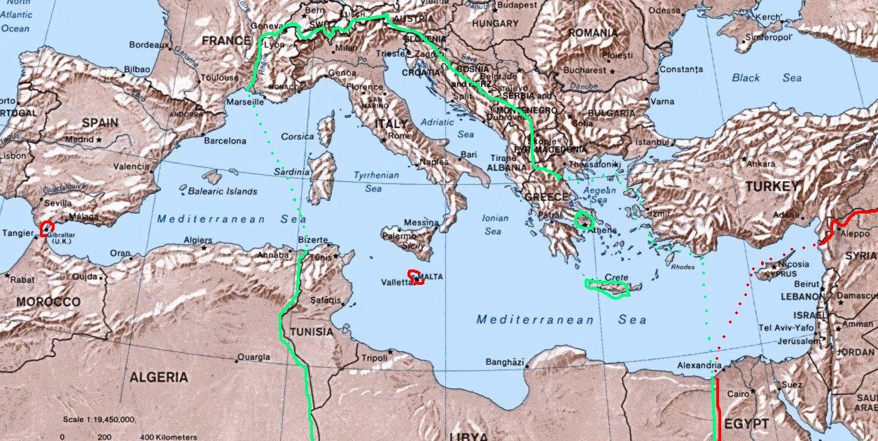
Popis:
Map of Italian "Mare Nostrum" (Italian Mediterranean), showing inside the green line & dots the italian areas in the Mediterranean sea during summer 1942 (in red those under British control). The remaining areas were under Axis control (Germany,Bulgary and Vichy France) and under friendly neutrality (Spain, Turkey).
Licence:
Public domain
Credit:
self-made (I have based my work on the original Commons Image:Mediterranean Relief.jpg, licensed PD-USGov)
Sdílet obrázek:


Relevantní obrázky
.svg)


.svg)
_crowned.svg)
.svg)

.svg)
.svg)
.svg)
.svg)
.svg)
.svg)


Relevantní články
Bitva o Středozemní mořeBitva ve Středozemním moři probíhala během druhé světové války především na zásobovacích cestách ve Středozemním moři. Zde se s výjimkou pacifických bitev odehrály největší námořní bitvy druhé světové války. .. pokračovat ve čtení