Jan Mayen map by Carl Vogt 1863
Autor:
Carl Vogt
Shortlink:
Zdroj:
Formát:
1476 x 918 Pixel (286537 Bytes)
Popis:
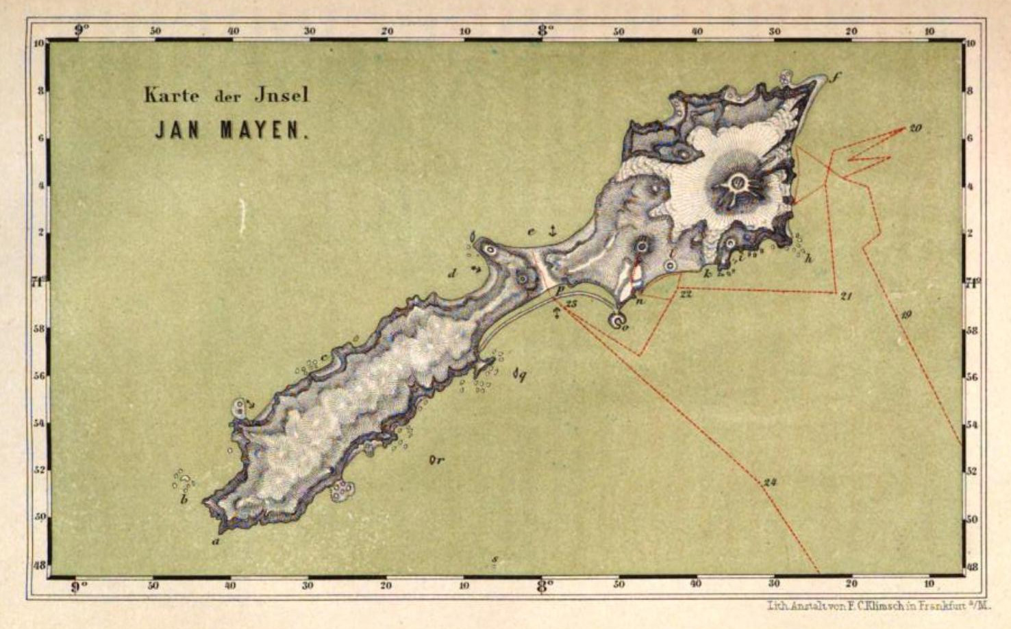
map of Jan Mayen island, Territory of Norway, North Atlantic Ocean
plate after page 286 of Book Nord-fahrt, entlang der Norwegischen Küste, nach dem Nordkap, den Inseln Jan Mayen und Island, auf dem Schooner Joachim Hinrich unternommen während der Monate Mai bis Oktober 1861 von Dr. Georg Berna, in Begleitung von C. Vogt, H. Hasselhorst, A. Greßly und A. Herzen by Carl Vogt, Frankfurt am Main 1863. Maßstab ca. 1:630.000, Lith. Anst. von F. C. Klimsch, mehrfarbige Lithographie, mit Bergstrichen, Originalmaße 18 x 11 cm,
plate after page 286 of Book Nord-fahrt, entlang der Norwegischen Küste, nach dem Nordkap, den Inseln Jan Mayen und Island, auf dem Schooner Joachim Hinrich unternommen während der Monate Mai bis Oktober 1861 von Dr. Georg Berna, in Begleitung von C. Vogt, H. Hasselhorst, A. Greßly und A. Herzen by Carl Vogt, Frankfurt am Main 1863. Maßstab ca. 1:630.000, Lith. Anst. von F. C. Klimsch, mehrfarbige Lithographie, mit Bergstrichen, Originalmaße 18 x 11 cm,
Licence:
Public domain
Sdílet obrázek:


Relevantní obrázky


Relevantní články
Jan MayenJan Mayen je vulkanický ostrov na rozhraní Norského a Grónského moře. Leží 600 km severně od Islandu, 500 km východně od Grónska a 1000 km západně od norské pevniny. .. pokračovat ve čtení