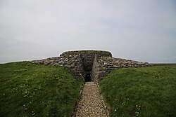
Lady Kirk, Sanday, Orkney - geograph.org.uk - 220173
(c) Beth Loft, CC BY-SA 2.0
Autor:
Shortlink:
Zdroj:
Formát:
640 x 428 Pixel (79111 Bytes)
Popis:
Lady Kirk, Sanday, Orkney. Lady Kirk lies between the B9069 and The Little Sea (aka The Peedie Sea) on the island of Sanday, in Orkney. The church dates back to 1773 but is thought to have been built on an earlier site and may include archeological features from a preceding building.
There is an external stairway to the ruined shell of the kirk, at the top of which may be found "The Devil's Handprint" (or "Devil's Clawmarks") - an impression of a "hand" in the stonework. There is a local tale regarding the handprint (see http://www.sanday.co.uk/nowthen/spooks.htm ), which is more likely due some form of erosion.
Licence:
Credit:
From geograph.org.uk
Relevantní obrázky

(c) Ian Balcombe, CC BY-SA 2.0

(c) John Comloquoy, CC BY-SA 2.0

(c) Rob Burke, CC BY-SA 2.0


Contains Ordnance Survey data © Crown copyright and database right, CC BY-SA 3.0


Relevantní články
Sanday (Orkneje)Sanday je po ostrovech Mainland a Hoy se svou rozlohou 50,43 km² v pořadí třetí největší ze sedmi desítek ostrovů v Orknejském souostroví. Z administrativního hlediska je ostrov v rámci Spojeného království součástí skotské správní oblasti Orkneje. .. pokračovat ve čtení
