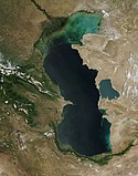
Lake Balkhash (MODIS)
Autor:
MODIS Land Rapid Response Team, NASA GSFC
Shortlink:
Zdroj:
Formát:
3692 x 2925 Pixel (869479 Bytes)
Popis:
The long, narrow Lake Balkhash stretches about 605 km (376 miles) from east to west, and has a maximum depth of about 25 meters (115 feet). Sitting in Kazakhstan, the lake covers an area of roughly 17,000 square kilometers (6,564 sq mi), although the surface area can vary depending on rainfall and the inflow from rivers, especially the Ili River, which carries about 70-80 percent of the lake’s freshwater into Lake Balkhash.
On July 18, 2023, the Moderate Resolution Imaging Spectrometer (MODIS) acquired a true-color image of Lake Balkhash which illustrates both its length and unusual coloration.
The water east of the Sarymesk Peninsula (north side of lake) is dark blue, relatively deep, but is brackish to salty. The western portion on the lake, on the other hand, is murky in color—most likely from suspended sediment—but is nearly fresh, making it suitable for drinking and industrial use.
Licence:
Public domain
Credit:
Tento mediální soubor byl katalogizován v Goddardově kosmickém středisku amerického Národního úřadu pro letectví a kosmonautiku (NASA)pod Photo ID: 2023-07-27.
Relevantní obrázky
Relevantní články
Bezodtoká oblastBezodtoká neboli endorheická oblast je území na zemském povrchu, které buď není odvodňováno vůbec, nebo sice je odvodňováno, ale voda neodtéká do žádného moře, které by bylo částí světového oceánu. Dá se definovat i jako území nepatřící k úmoří žádného oceánu. .. pokračovat ve čtení


