Lake Pend Oreille
Autor:
U.S. Army Corps of Engineers, photographer not specified or unknown
Shortlink:
Zdroj:
Formát:
1500 x 1001 Pixel (365395 Bytes)
Popis:
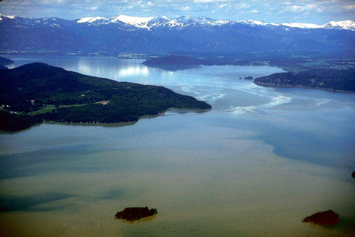
Aerial view of Lake Pend Oreille on the Pend Oreille River in 1993.
Komentář k Licence:
This image or file is a work of a U.S. Army Corps of Engineers soldier or employee, taken or made as part of that person's official duties. As a work of the U.S. federal government, the image is in the public domain.
Licence:
Public domain
Credit:
U.S. Army Corps of Engineers Digital Visual Library
Image page
Image description page
Digital Visual Library home page
Image page
Image description page
Digital Visual Library home page
Sdílet obrázek:


Relevantní obrázky


Relevantní články
Scotchman PeakScotchman Peak je hora v Bonner County, na severu Idaha. Leží v západní části pohoří Cabinet Mountains, které svojí většinou leží ve státě Montana. Hora s nadmořskou výškou 2 137 metrů je významná svojí prominencí 1 418 metrů, která z ní činí pátý nejprominentnější vrchol v Idahu. Scotchman Peak leží v národním lese Kaniksu National Forest, něco přes deset kilometrů východně od největšího idažského jezera Lake Pend Oreille. .. pokračovat ve čtení