Maiden Way - geograph.org.uk - 621822
Autor:
Shortlink:
Zdroj:
Formát:
640 x 480 Pixel (152337 Bytes)
Popis:
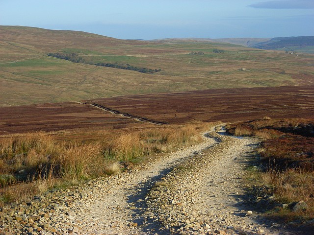
Maiden Way This is a Roman Road and heads towards Whitley Castle at Kirkhaugh. It was taken from where the track heads southeast to Smittergill Head. This is the more prominent of the two ways to the south.
Licence:
Credit:
From geograph.org.uk
Sdílet obrázek:


Relevantní obrázky

(c) Chris Heaton, CC BY-SA 2.0

Relevantní články
Maiden WayMaiden Way byla starověká římská silnice o délce přibližně 32 km, která v severní Británii spojovala římskou pevnost Bravoniacum poblíž města Penrith s pevností Magnis (Carvoran) na Hadriánově valu, přičemž zhruba v polovině cesty mezi nimi ležela pevnost Epiacum. .. pokračovat ve čtení