Map Saipan Tinian islands closer
Autor:
map:US Geological Survey
Shortlink:
Zdroj:
Formát:
290 x 410 Pixel (31458 Bytes)
Popis:
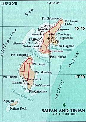
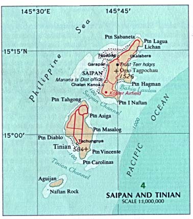
Map of the islands of Saipan and Tinian in the Northern Mariana Islands along the Marianas Trench (east of China and the Philippines).
Licence:
Public domain
Credit:
Derived by cropping US Government (USNA) map: http://www.lib.utexas.edu/maps/australia/saipan_tinian_islands.jpg
linked as being a US National Atlas (1970) map on related webpage: http://www.lib.utexas.edu/maps/northern_mariana_islands.html .
linked as being a US National Atlas (1970) map on related webpage: http://www.lib.utexas.edu/maps/northern_mariana_islands.html .
Sdílet obrázek:


Relevantní obrázky


Relevantní články
TinianTinian je jeden ze tří nejvýznamnějších ostrovů Severních Marian. Spolu se sousedním neobydleným ostrovem Aguigan tvoří municipalitu Tinian, která se třemi dalšími municipalitami konstituuje Severní Mariany. Největší vesnicí na Tinianu je San Jose. .. pokračovat ve čtení