Map ancient athens
Autor:
Shortlink:
Zdroj:
Formát:
1000 x 750 Pixel (40438 Bytes)
Popis:
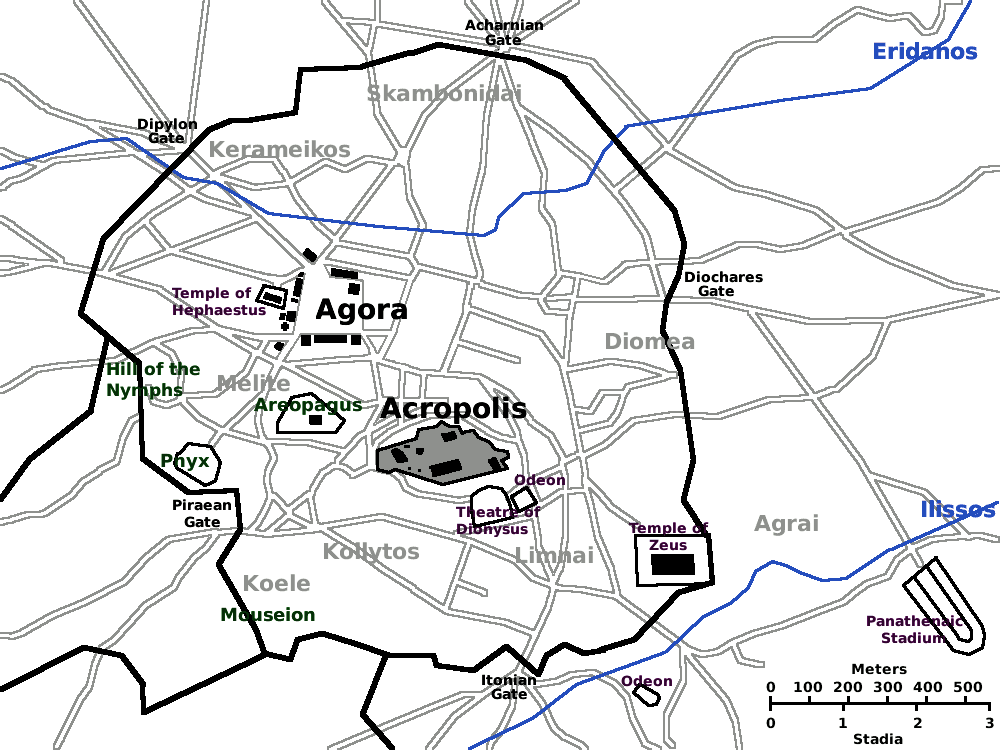
Map of Ancient Athens c. 430 BC. (Athen, Athenes, Atene, Atenas). Based on the Image:Karte Athen MKL1888.png from the 1888 edition of Meyers Konversationslexikon. Revised with modern updates, but not showing the Roman-era features.
Licence:
Public domain
Credit:
Vlastní dílo
Sdílet obrázek:


Relevantní obrázky


Relevantní články
Starověké AthényAthény, řecky Αθήναi Athénai, byly starověkým městským státem (polis) a jedním z nejvýznamnějších center starověkého Řecka. .. pokračovat ve čtení