Maricopa County Incorporated and Planning areas Mesa highlighted
Autor:
Shortlink:
Zdroj:
Formát:
940 x 812 Pixel (1102414 Bytes)
Popis:
This map shows the incorporated areas and Indian reservation boundaries in Maricopa County, Arizona, along with water bodies and major highways and roads. Mesa is highlighted in red. Other incorporated cities are shown in gray, planning area borders for these cities and Indian reservation borders are shown as solid black lines. Changes from Previous Version: Updated the maps to include water bodies and to make "less boring" than the plain black/white/gray maps. Format was updated to match standards laid out by WikiProject Maps/Conventions. Map data is based on data from the following Webpage: Maricopa County Interactive GIS Map. I created this map in Inkscape.
Licence:
Public domain
Credit:
Text messages pictures
Relevantní obrázky
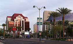
Relevantní články
MesaMesa je město v americkém státě Arizona. Nachází se v metropolitní oblasti Phoenixu, přibližně 30 km na východ od vlastního Phoenixu. Je pojmenováno po prezidentovi Andrewu Jacksonovi. Je to třetí největší město v Arizoně a 38. největší město v USA .. pokračovat ve čtení


