Modiin1870s
Autor:
No machine-readable author provided. Zero0000 assumed (based on copyright claims).
Shortlink:
Zdroj:
Formát:
1094 x 1046 Pixel (251101 Bytes)
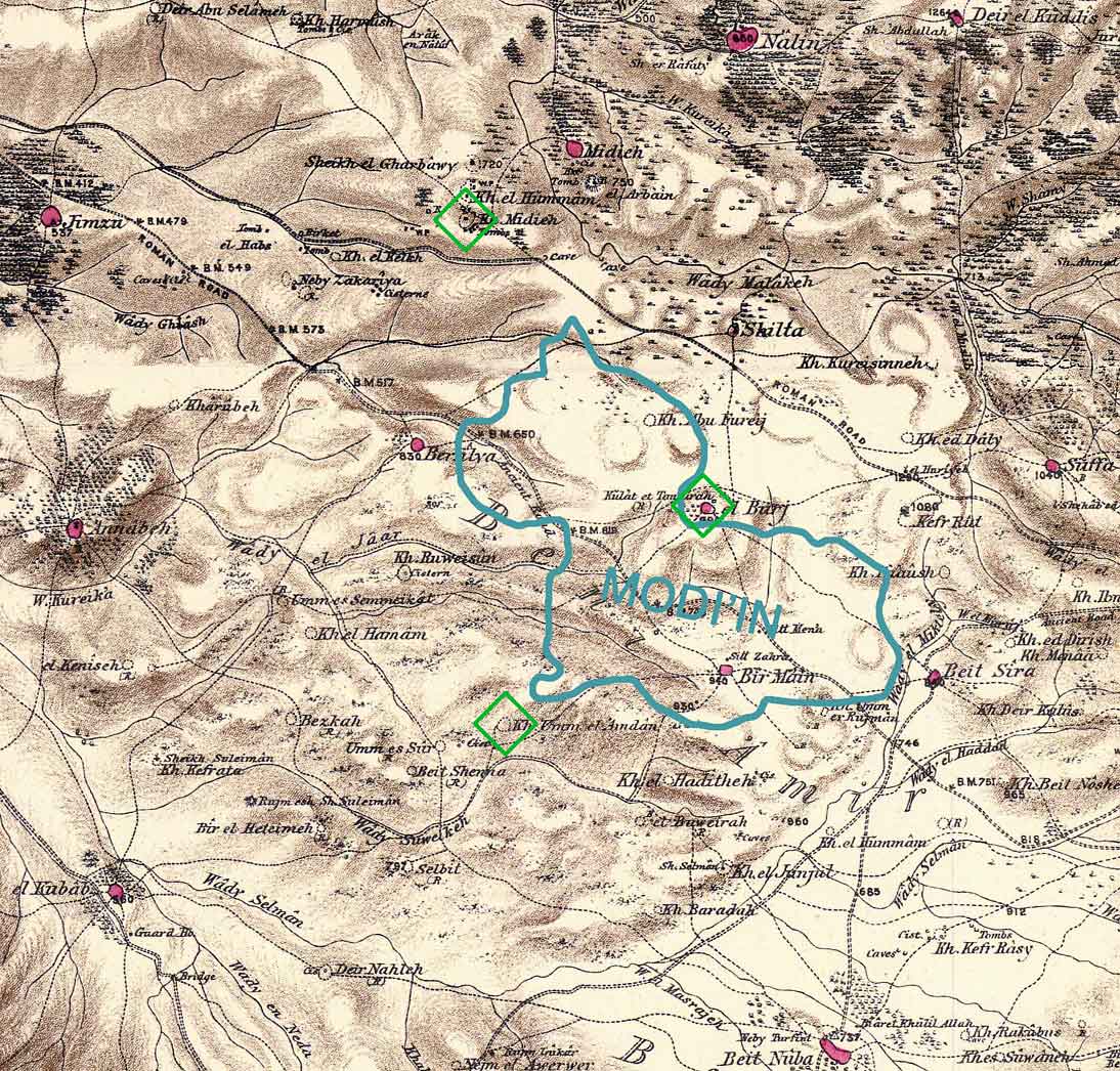
Popis:
Combination of portions of two maps produced by the Survey of Western Palestine, first published in 1880 by the Committee of the Palestine Exploration Fund. The editor, Walter Besant, died in 1901. The blue shape gives the approximate boundaries of the build-up area of Modi'in in 2006 (Google Earth). The green diamonds show three scientific theories regarding the location of the ancient city of Modi'in. There are other popular theories.
Produced by Zero0000 using Photoshop 7.0.
Licence:
Public domain
Credit:
No machine-readable source provided. Own work assumed (based on copyright claims).
Sdílet obrázek:


Relevantní obrázky


Relevantní články
Modi'in-Makabim-Re'utModi'in-Makabim-Re'ut je město nacházející se v Centrálním distriktu v Izraeli, které vzniklo v prosinci 2003 spojením měst Modi'in s nedalekou obcí Makabim-Re'ut. .. pokračovat ve čtení