Moresnet Karte
|
Toto dílo je volné také v zemích, jejichž právní řád chrání majetková autorská práva po dobu života autora a 70 let po jeho smrti.
| |
| Bylo zjištěno, že u tohoto souboru nejsou známa žádná omezení daná autorským právem a právy s ním souvisejícími. | |


Relevantní obrázky


.svg)
.svg)
.svg)
.svg)

Relevantní články
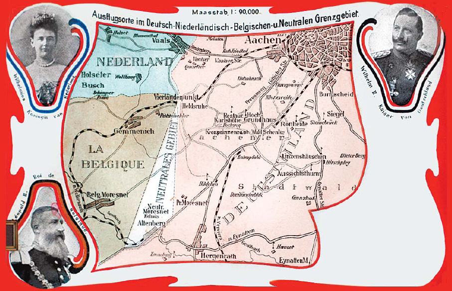
Neutrální MoresnetNeutrální Moresnet, jinak také Altenberg, bylo drobné evropské neutrální území o velikosti zhruba 3,5 km², existující mezi lety 1816 až 1915, resp. 1919. Vzniklo proto, že jeho dva velcí sousedi nebyli schopni se domluvit, komu z nich má patřit, a tak se rozhodli z něj vytvořit kondominium. Toto území se rozkládalo asi 7 km jihozápadně od Cách (Aachen), přesně na jih od trojmezí hranic Německa, Belgie a Nizozemí na vrchu Vaalserbergu. Dnes je součástí Belgie. .. pokračovat ve čtení