Ngorongoro topo
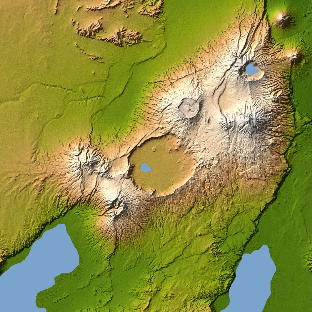
Ngorongoro’s caldera is 22.5 kilometers (14 miles) across at its widest point and is 610 meters (2,000 feet) deep. Its floor is very level, holding a lake fed by streams running down the caldera wall. It is part of the Ngorongoro Conservation Area and is home to over 75,000 animals. The lakes south of the crater are Lake Eyasi and Lake Manyara, also part of the conservation area.
Orientation: North toward the top, Mercator projection
Image Data: shaded and colored SRTM elevation model. The shade image was derived by computing topographic slope in the northwest-southeast direction, so that northwest slopes appear bright and southeast slopes appear dark. Color coding is directly related to topographic height, with green at the lower elevations, rising through yellow and tan, to white at the highest elevations.
Date Acquired: February 2000


Relevantní obrázky


Relevantní články
NgorongoroNgorongoro je rozlehlé území rozprostírající se mezi stěnami obrovské kaldery, prastarého vyhaslého vulkánu v severní Tanzanii. Přesná poloha tohoto tzv. „osmého divu světa“ je 180 km od západně od města Arusha. Dno kaldery leží ve výšce 1 800 m, její stěny jsou pak o asi 600 m vyšší. V kaldeře o rozloze 260 km² se nachází největší koncentrace volně žijících afrických zvířat, včetně tzv. Velké pětky. Žije zde přibližně 30 000 jedinců. Masajové toto místo pojmenovali Dar života. .. pokračovat ve čtení