NorthSeaCurrents
Přisuzování:
Obrázek je označen jako „Vyžadováno uvedení zdroje“ (Attribution Required), ale nebyly uvedeny žádné informace o přiřazení. Při použití šablony MediaWiki pro licence CC-BY byl pravděpodobně parametr atribuce vynechán. Autoři zde mohou najít příklad pro správné použití šablon.
Shortlink:
Zdroj:
Formát:
1300 x 1700 Pixel (3594888 Bytes)
Popis:
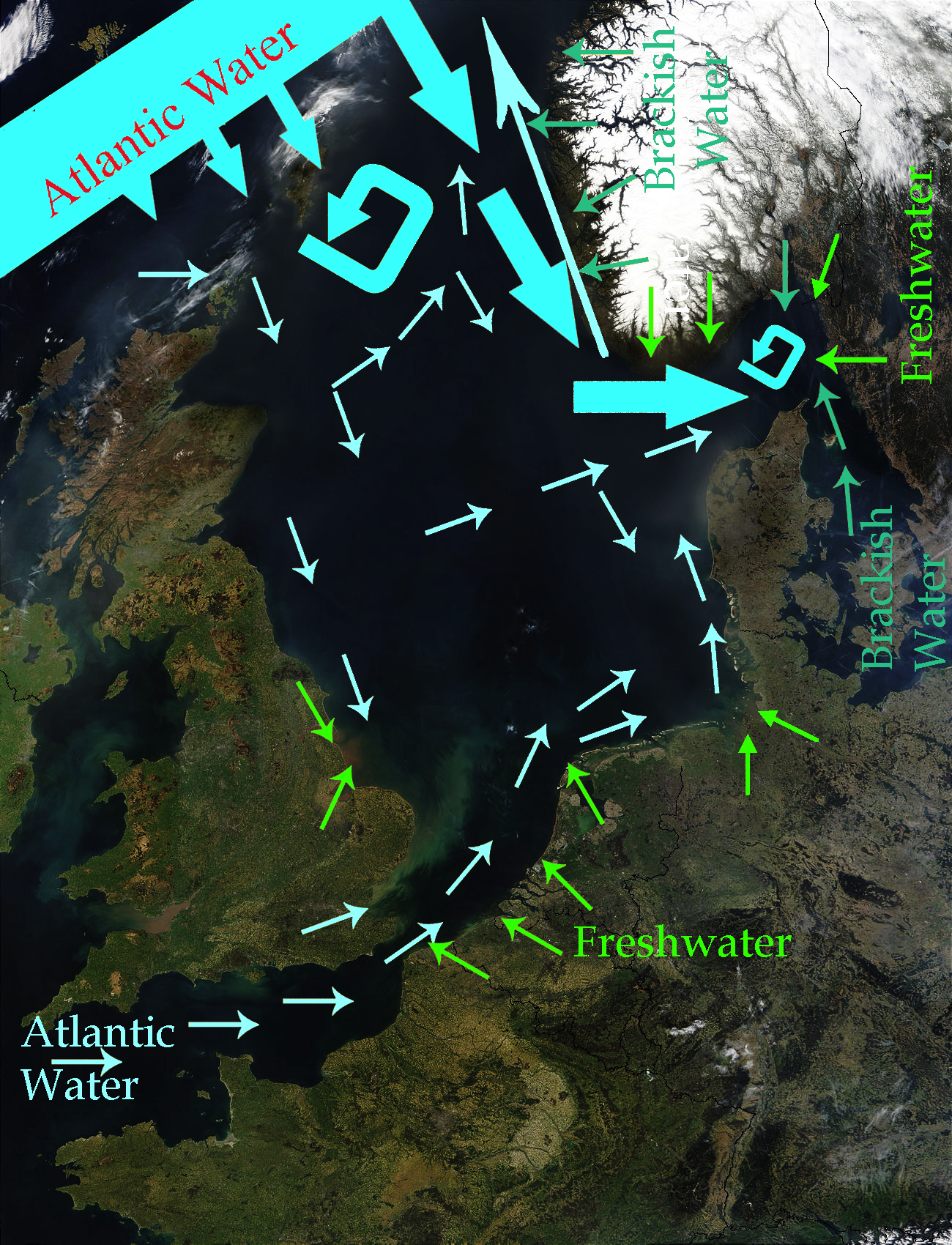
North Sea Map derived from NASA satellite image. This image depicts the currents in the North Sea. The intensive light blue broad arrows show the current and amount of flow from the Atlantic Ocean entering the northern area of the North Sea The smaller pale yellow arrows represent the current from the Atlantic Ocean entering through the English Channel. The bluish green arrows represent brackish water from fjords and the Baltic Sea. The green arrows represent freshwater from various rivers which drain land areas and discharge into the North Sea. Sources used to base this map upon were Safety at Sea currents and North Sea physiography (depth distribution and main currents) Guide to the Oceans By John Pernetta page 184 It would be nice to re-do this map with wiggly flowing arrows for the water currents.
Licence:
Credit:
Derivative work from File:NASA NorthSea1 2.jpg
Sdílet obrázek:


Relevantní obrázky


.svg)

.svg)
.jpg)


Relevantní články
Severní mořeSeverní moře je okrajové, šelfové moře Atlantského oceánu. Nachází se na severozápadě Evropy. Na západě je ohraničeno Britskými ostrovy, Orknejemi a Shetlandami, na východě Skandinávským a Jutským poloostrovem a na jihu pobřežím Evropy. Omývá pobřeží Velké Británie, Francie, Belgie, Nizozemska, Německa, Dánska a Norska. Má rozlohu 570 000 km². Dosahuje průměrné hloubky 96 m a maximální 809 m ve Skagerraku. Celkový objem vody je 42 000 km³. .. pokračovat ve čtení