Pakistan earthquake satellite
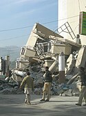
On October 8, 2005, a large earthquake shook the mountainous Kashmir region near the border of Pakistan and India. Tens of thousands of people died, and many more were isolated in the mountains by damage to roads and bridges as well as by landslides. Heavy winter snowfall poses an additional threat to millions of survivors made homeless by the quake.
In the first week of January 2006, a new snow storm blanketed the mountains of Pakistan, including the region around the epicenter of the quake. This image from the Moderate Resolution Imaging Spectroradiometer (MODIS) on NASA’s Aqua satellite shows snow highlighting the ridges and ravines in the mountains northeast of the city of Islamabad on January 6. According to news reports on the BBC Website, the snow is hampering aid efforts to some areas, and avalanches triggered by earthquake aftershocks continue to threaten people in some mountainous areas.Relevantní obrázky
Relevantní články
MuzaffarabádMuzaffarabád je hlavní město provincie Azad Kašmír v Pákistánu. Nachází se na březích řek Jhelum a Neelum ve stejnojmenném regionu Muzaffarabád. Podle sčítání lidu z roku 1998 region obývalo 725 000 lidí, kdy rok poté se populace odhadovala už na 741 000 lidí. Město se nachází 138 kilometrů od Islámábádu a města Rawalpindi, či 76 kilometrů od Abbottabádu. Ve městě se mísí mnoho kultur a jazyků. Hlavním jazykem je však Hindština. Mikroklima oblasti je velmi ovlivňováno právě řekami v okolí města. .. pokračovat ve čtení


