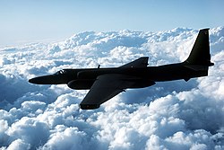
RQ-1 Predator in flight near USS Carl Vinson (CVN-70) 951205-N-3149J-006


Autor:
Petty Officer 3rd Class Jeffrey S. Viano, U.S. Navy
Formát:
2347 x 1513 Pixel (545862 Bytes)
Popis:
Predator Unmanned Aerial Vehicle (UAV) flies on a simulated Navy aerial reconnaissance flight near the aircraft carrier USS Carl Vinson (CVN 70) off the coast of southern California on Dec. 5, 1995. The Predator provides near, real-time infrared and color video to intelligence analysts and controllers on the ground and the ship. This is the Predator's first maritime mission with a carrier battle group. The UAV was launched from San Nicholas Island off the coast of southern California.
Komentář k Licence:
This file is a work of a sailor or employee of the U.S. Navy, taken or made as part of that person's official duties. As a work of the U.S. federal government, it is in the public domain in the United States.
Licence:
Public domain
Credit:

This image was released by the United States Navy with the ID 951205-N-3149J-006 (next).
This tag does not indicate the copyright status of the attached work. A normal copyright tag is still required. See Commons:Licensing.


العربية  বাংলা  Deutsch  Deutsch (Sie-Form)  English  español  euskara  فارسی  français  italiano  日本語  한국어  македонски  മലയാളം  Plattdüütsch  Nederlands  polski  پښتو  português  русский  slovenščina  svenska  Türkçe  українська  简体中文  繁體中文  +/−

Sdílet obrázek:
Facebook   Twitter   Pinterest   WhatsApp   Telegram   E-Mail
Více informací o licenci na obrázek naleznete zde. Poslední aktualizace: Tue, 02 Apr 2024 20:50:33 GMT

Relevantní obrázky


Relevantní články

Průzkumný letoun

Průzkumný letoun je vojenský letoun používaný k monitorování nepřátelské aktivity. .. pokračovat ve čtení

General Atomics Aeronautical Systems

General Atomics Aeronautical Systems, Inc. je dceřiná společnost General Atomics vyrábějící bezpilotní letadla a radarové systémy pro americké ozbrojené síly, nabízené na komerčním základě i dalším zákazníkům z celého světa. .. pokračovat ve čtení

Fotografická interpretace

Fotografická interpretace může být definována jako „činnost posuzování fotografických snímků za účelem identifikace objektů a hodnocení jejich významu“. Analýzu satelitních snímků vede specialista známý jako fotografický interpret - v anglické zkratce „PI“. .. pokračovat ve čtení