Ryknild street
Autor:
Shortlink:
Zdroj:
Formát:
640 x 480 Pixel (178904 Bytes)
Popis:
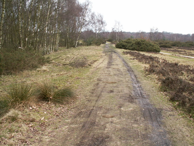
Ryknild Street Roman Road, Sutton Park. Ryknild Street Roman Road, Sutton Park
Looking north east. The 1.5 mile section of the Roman road that runs through Sutton Park is one of the best preserved in the country, clearly showing the constructional features typical of roads in this part of the empire. This section of road linked the forts at Metcley (Birmingham) and Wall near Lichfield.
Komentář k Licence:
Creative Commons Attribution Share-alike license 2.0
Licence:
Credit:
From geograph.org.uk
Sdílet obrázek:


Relevantní články
Icknield StreetIcknield Street také známá jako Ryknild Street je římská silnice ve Velké Británii, která vede od Fosse Way v Bourtonu on the Water v hrabství Gloucestershire do Templeborough v hrabství Jižní Yorkshire. Vede přes Alcester, Studley, Redditch, Metchley Fort, Birmingham, Lichfield a Derby. .. pokračovat ve čtení