SaltGlaciers ZagrosMtns 20010810
Autor:
NASA/GSFC/MITI/ERSDAC/JAROS, and U.S./Japan ASTER Science Team
Shortlink:
Zdroj:
Formát:
1149 x 731 Pixel (236626 Bytes)
Popis:
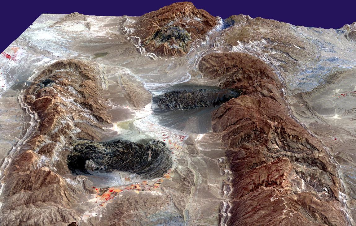
Satellite imagery of salt domes and salt glaciers, visible as darkish irregular patches, Zagros Mountains, southern Iran, near Karmowstaj. Gravity has caused the salt to flow like glaciers into adjacent valleys. The resulting tongue-shaped bodies are more than 5 kilometers long, with repeating bow-shaped ridges separated by crevasse-like gullies and with steep sides and fronts. The darker tones are due to clays brought up with the salt, as well as the probable accumulation of airborne dust. This Aster perspective view was created by draping a band 3-2-1 (RGB) image over an ASTER-derived Digital Elevation Model (2x vertical exaggeration).
Komentář k Licence:
US government, public domain
Licence:
Public domain
Sdílet obrázek:


Relevantní články
GeologieGeologie je přírodní věda zaměřující se na procesy neživé přírody v rámci známého vesmíru. Zkoumá složení, stavbu a historický vývoj země a jiných vesmírných objektů. .. pokračovat ve čtení