Satellite image of the Grand Canyon
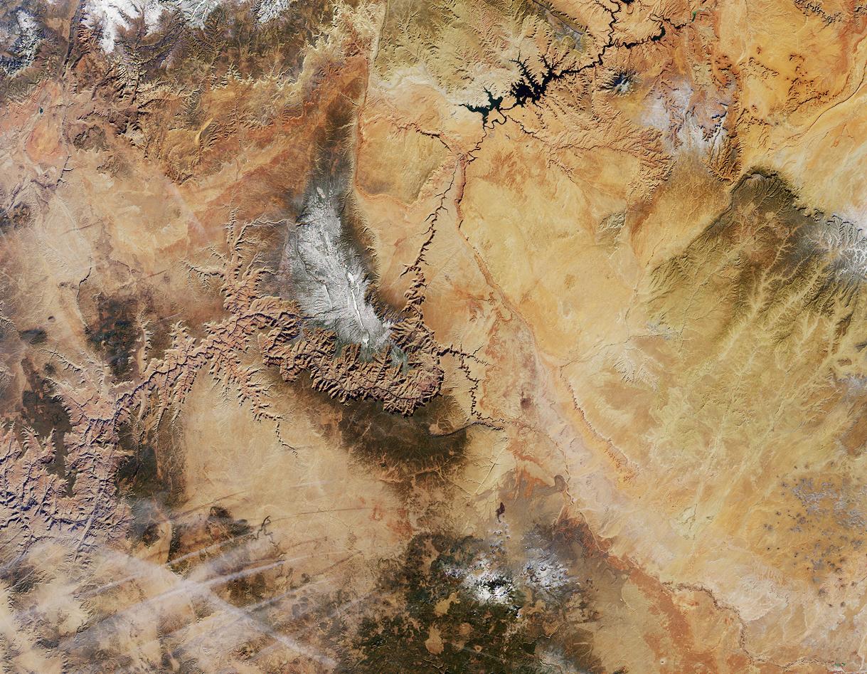
Northern Arizona and the Grand Canyon are captured in this pair of Multi-angle Imaging Spectroradiometer (MISR) images from December 31, 2000. The above image is a true color view from the nadir (vertical) camera. A stereo composite image was generated using data from MISR's vertical and 46-degree-forward cameras. Viewing the stereo image in 3-D requires the use of red/blue glasses with the red filter placed over your left eye. To facilitate stereo viewing, the images have been oriented with north at the left.
In addition to the Grand Canyon itself, which is visible in the western (lower) half of the images, other landmarks include Lake Powell, on the left, and Humphreys Peak and Sunset Crater National Monument on the right. Meteor Crater appears as a small dark depression with a brighter rim, and is just visible along the upper right-hand edge. Can you find it?
(NOTE: The image in this wiki has been rotated relative to the one on the NASA site, so the preceding description's references to "left", etc., are incorrect.)


Relevantní obrázky


Relevantní články
Grand CanyonGrand Canyon je kaňon na řece Colorado v severozápadní části Arizony, ve Spojených státech amerických. Grand Canyon se rozkládá od přítoku řeky Little Colorado až k Grand Wash Cliffs na západním okraji Koloradské plošiny, u hranice s Nevadou. Délka Velkého kaňonu je přibližně 450 kilometrů, šířka je 6 až 29 kilometrů a maximální hloubka se pohybuje mezi 1 600 až 1 800 metrů. Okraje náhorní plošiny leží v nadmořské výšce 1 500 až 2 700 metrů. .. pokračovat ve čtení