Scandinavia.TMO2003050
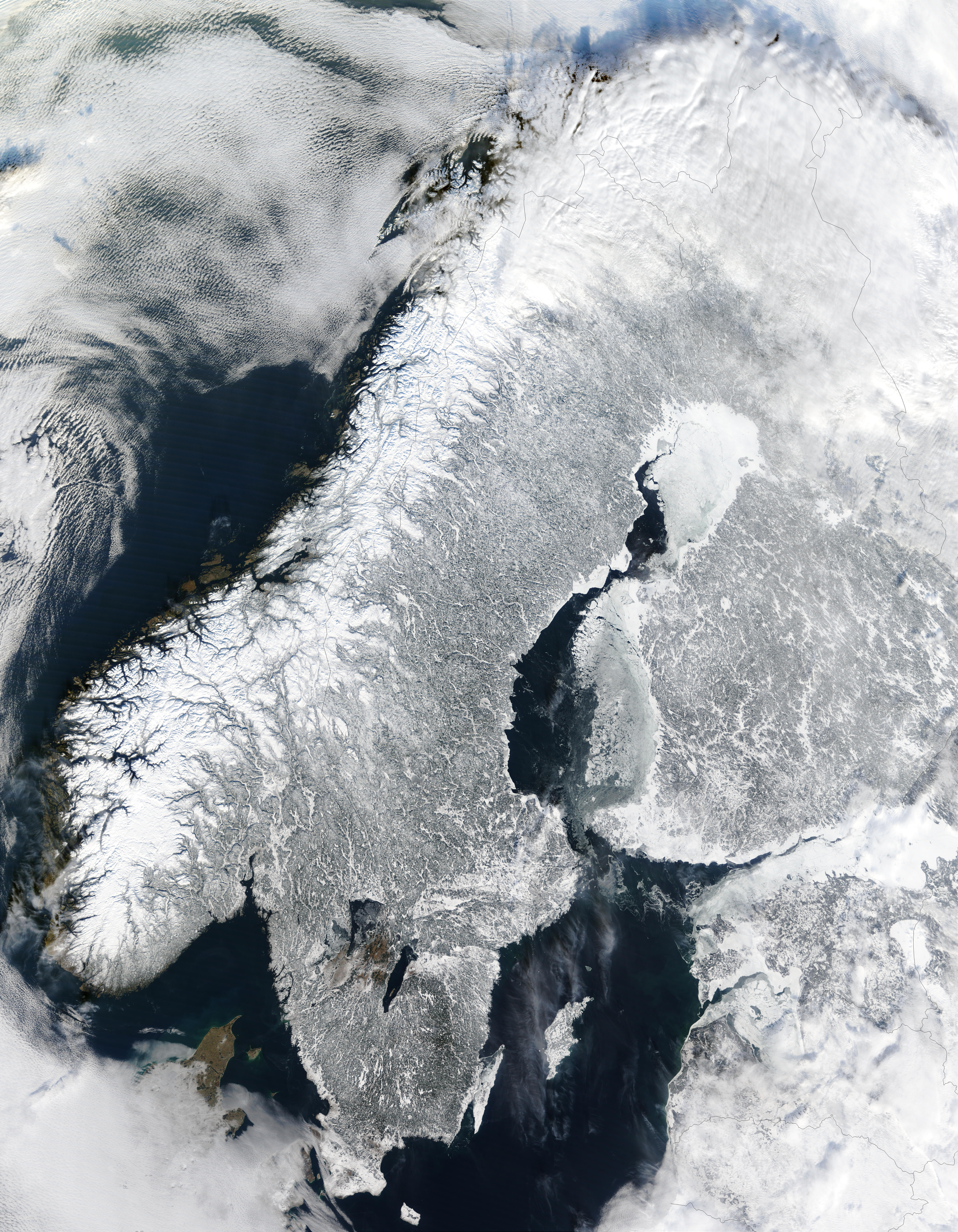
The Moderate Resolution Imaging Spectroradiometer (MODIS) instrument aboard NASA’s Terra satellite captured the above image of the Scandinavian Peninsula on February 19, 2003.
With a landscape largely shaped by glaciers over the last ice age, the Scandinavian Peninsula is as picturesque in the winter as it is cold. Along the left side of the peninsula, one can see the jagged inlets, known as fjords, lining Norway’s coast. Many of these fjords are well over 2,000 feet (610 meters) deep and were carved out by extremely heavy, thick glaciers that formed during the last ice age. The glaciers ran off the mountains and scoured troughs into Norway’s coastline with depths that reached well below sea level. When the glaciers melted, the seawater rushed into these deep troughs to form the fjords. The deepest fjord on Norway’s coast, known as Sogn Fjord, lies in southwest Norway and is 4,291 feet (1,308 m) deep.


Relevantní obrázky
.jpg)


.jpg)
.png)


.jpg)

_en2.png)


.jpg)


.jpg)

_3.jpg)


.jpg)

.svg)


Relevantní články
ŠvédskoŠvédsko je jedním ze severských států na Skandinávském poloostrově v severní Evropě. Švédsko hraničí na západě s Norskem, na severovýchodě s Finskem a na jihu je spojeno s Dánskem unikátním mostem-tunelem přes průliv Öresund. .. pokračovat ve čtení
Skandinávský poloostrovSkandinávský poloostrov je velký poloostrov v severní Evropě. Má rozlohu asi 750 000 km² a je omýván z jihovýchodu Baltským mořem, z jihozápadu Severním mořem, ze severozápadu Norským mořem a ze severu Barentsovým mořem. Na severovýchodě je asi 480 km širokou šíjí mezi Botnickým zálivem a Kjøfjordem spojen se zbytkem evropské pevniny. Technicky je součástí ještě většího poloostrova, tzv. Fennoskandinávie, která zahrnuje i finsko-karelský pevninský most a poloostrov Kola. Od roku 2000 je na jižním konci propojen s dánským ostrovem Sjælland dálničním mostem přes Öresund, má tak přímé silniční spojení s Evropou z obou stran. .. pokračovat ve čtení