Seto-Inland-Sea-Photo
Autor:
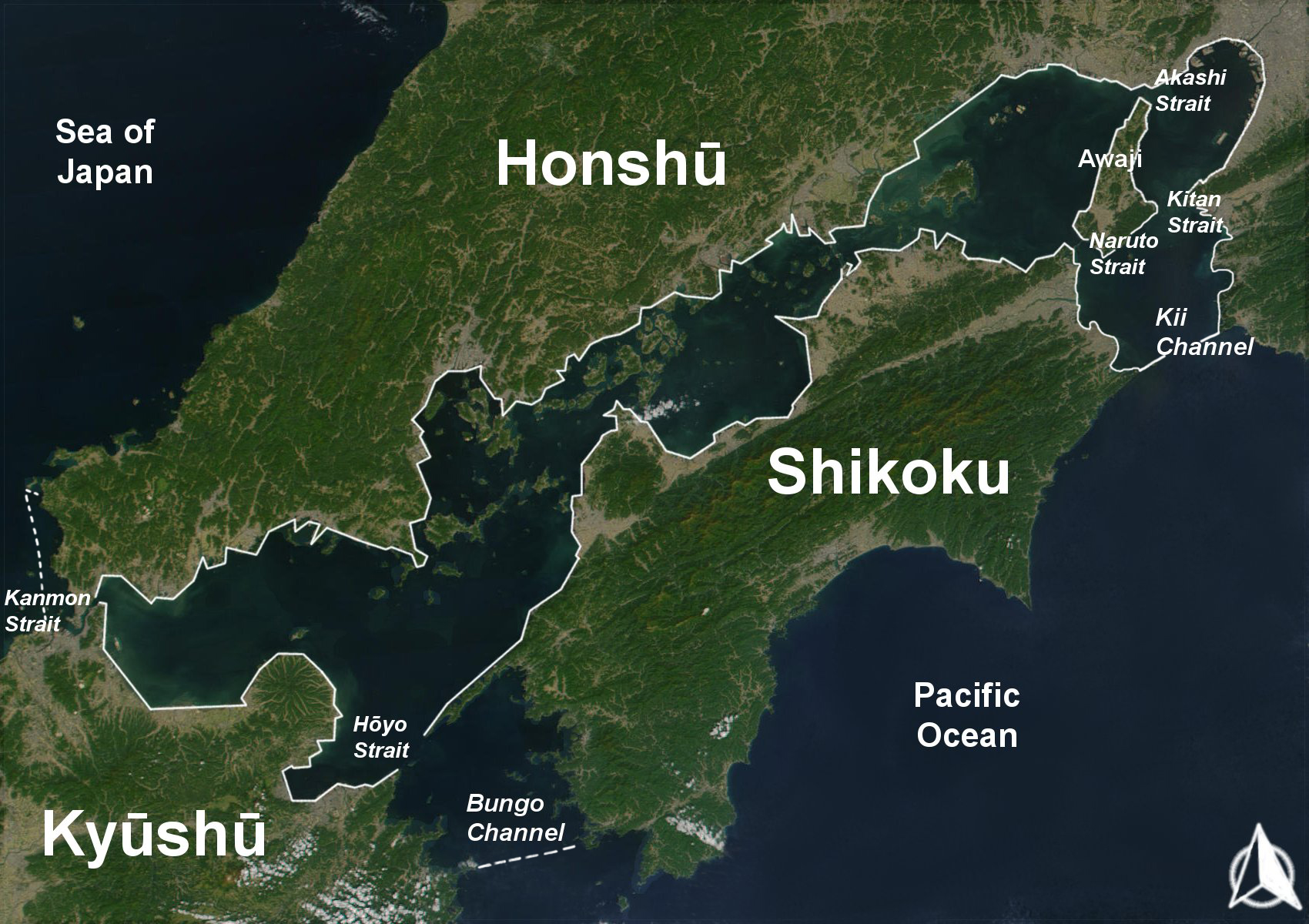
User:Guenny (Christian Günther) made this map of the Japanese Inland Sea (Setonaikai,瀬戸内海) for the German Wikipedia. de:Seto-Inlandsee. It's showing the Japanese islands surrounding the sea with the major straits and channels. Guenny is willing to do translations to other languages if needed, as well as corrections and enhancements.
Přisuzování:
Obrázek je označen jako „Vyžadováno uvedení zdroje“ (Attribution Required), ale nebyly uvedeny žádné informace o přiřazení. Při použití šablony MediaWiki pro licence CC-BY byl pravděpodobně parametr atribuce vynechán. Autoři zde mohou najít příklad pro správné použití šablon.
Shortlink:
Zdroj:
Formát:
1700 x 1200 Pixel (967202 Bytes)
Popis:
The Range of the Seto Inland Sea by the Territorial Sea Law (領海及び接続水域に関する法律) is 19,700 km2 (solid lines). Reference: Seto_Inland_Sea01.png . The Range of the Seto Inland Sea according to the Setouchi Law and the Setouchi Law Enforcement Order is 21,827 km2 (solid lines and dashed lines). Reference: Seto_Inland_Sea02.png.
Licence:
Credit:
Based on a Public-Domain-Satellite photo of NASA
Sdílet obrázek:


Relevantní obrázky


Relevantní články
Vnitřní moře (Japonsko)Vnitřní moře je vodní plocha mezi japonskými ostrovy Honšú, Šikoku a Kjúšú. Spojuje Japonské moře s Tichým oceánem. .. pokračovat ve čtení