Trinity crater
Autor:
Federal government of the United States
Shortlink:
Zdroj:
Formát:
7880 x 6263 Pixel (6635840 Bytes)
Popis:
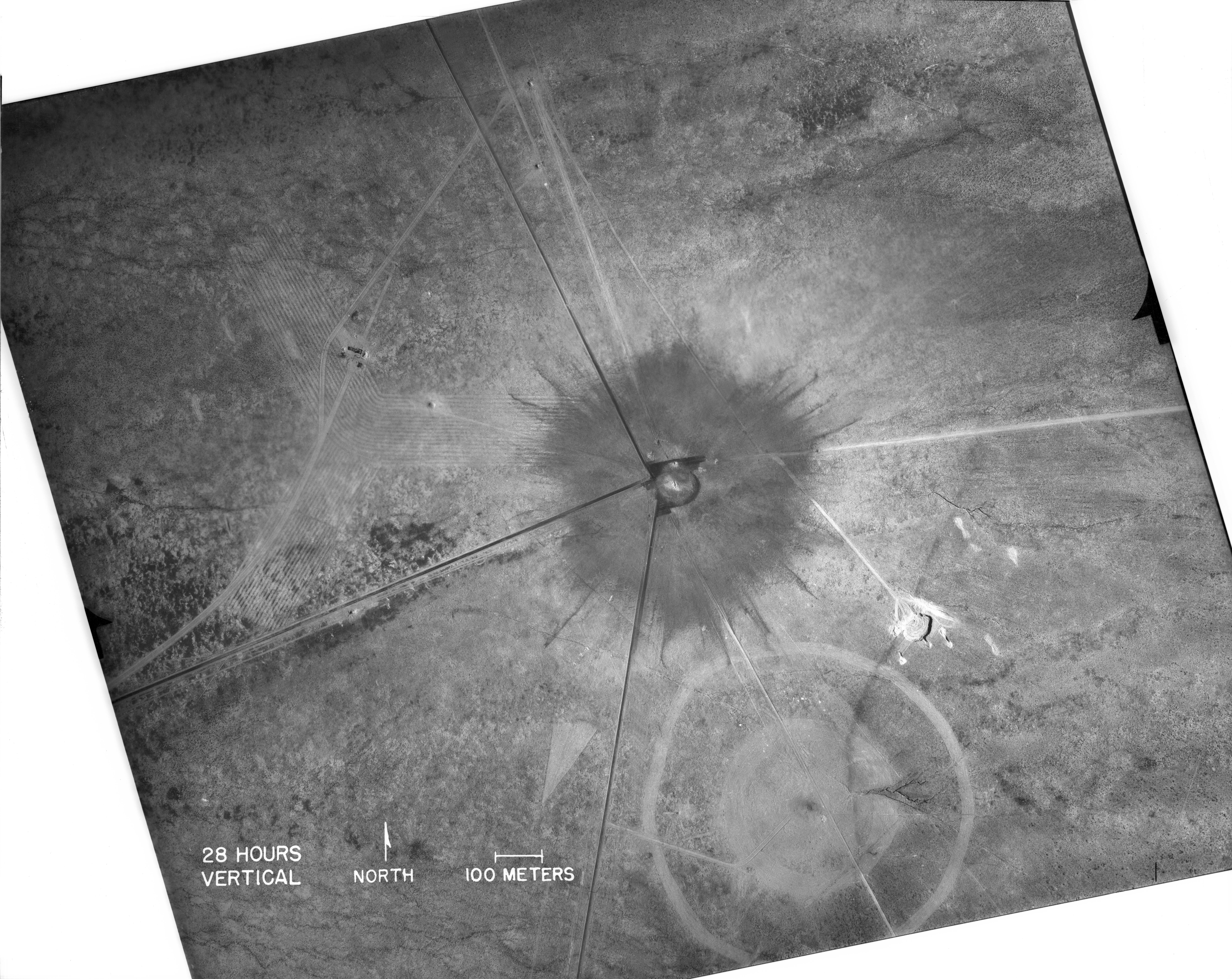
White Sands, New Mexico. Aerial view of the aftermath of the Trinity test, 28 hours after the explosion. The smaller crater to the southeast is from the earlier detonation of 100 tons of TNT on May 7, 1945. The dark straight lines are roads. To the left of the crater can be seen the "Jumbo" container, unharmed, and its collapsed tower (a vertical line).
Licence:
Public domain
Credit:
| This image is available from the National Nuclear Security Administration Nevada Site Office Photo Library under number 99150.
This tag does not indicate the copyright status of the attached work. A normal copyright tag is still required. |
Sdílet obrázek:


Relevantní obrázky


.jpg)


Relevantní články
Trinity (jaderný test)Trinity byl historicky první jaderný test. Provedly jej Spojené státy americké 16. července 1945 v Novém Mexiku, 56 km (35 mil) jihovýchodně od Socorro. Jednalo se o jaderný výbuch plutoniové jaderné zbraně. Stejného typu byla i bomba Fat Man, která byla později svržena na Nagasaki. Exploze Trinity byla ekvivalentní výbuchu 20 kilotun trinitrotoluenu. .. pokračovat ve čtení