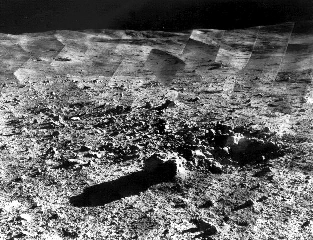
Tycho Crater Panorama
Since the landing site survey for the Apollo missions had been successfully completed by the previous Surveyors, the landing site for Surveyor 7 was selected more for its scientific interest. Surveyor 7, in addition to taking thousands of images and gathering a wide variety of surface data, performed star surveys, took pictures of Earth, and tested laser-pointing techniques by detecting laser beams from Earth.
The primary objectives of the Surveyor program having already been met by the previous missions, Surveyor 7 was sent to perform a soft landing in a type of terrain different from the previous Surveyors. Other objectives were to obtain images of the landing site, manipulate the soil and analyze its composition, and obtain temperature and radar reflectivity data.


Relevantní obrázky


Relevantní články
Surveyor 7Surveyor 7 byla umělá sonda, vyslaná agenturou NASA na Měsíc v roce 1968. V katalogu COSPAR dostala označení 1968-001A. .. pokračovat ve čtení