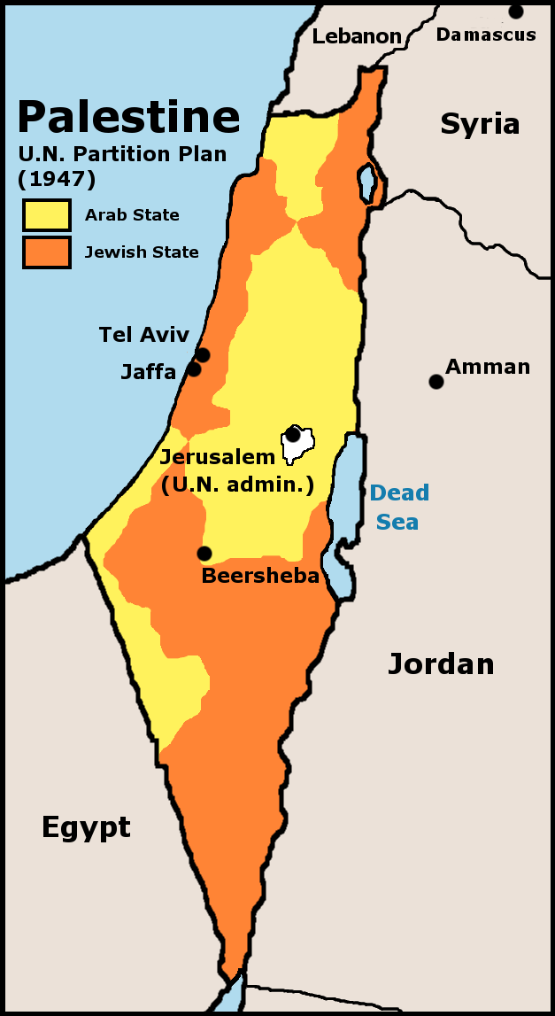
UN Partition Plan For Palestine 1947
Autor:
U.S. Central Intelligence Agency
Shortlink:
Zdroj:
Formát:
627 x 1147 Pixel (67027 Bytes)
Popis:
UN 1947 partition plan for Palestine
Komentář k Licence:
Licence:
Public domain
Credit:
Crop and edit of http://www.lib.utexas.edu/maps/historical/israel_hist_1973.jpg, Scan from “Issues in the Middle East”, Atlas, U.S. Central Intelligence Agency, 1973.
Sdílet obrázek:


Relevantní obrázky

.svg)

.svg)

.svg)


Relevantní články
Mandátní PalestinaMandátní Palestina nebo Mandátní území Palestina byla geopolitická entita, která existovala mezi lety 1920 a 1948 v oblasti Blízkého východu podle podmínek mandátu Společnosti národů pro Palestinu. .. pokračovat ve čtení