United States 1860-1870
Autor:
Přisuzování:
Obrázek je označen jako „Vyžadováno uvedení zdroje“ (Attribution Required), ale nebyly uvedeny žádné informace o přiřazení. Při použití šablony MediaWiki pro licence CC-BY byl pravděpodobně parametr atribuce vynechán. Autoři zde mohou najít příklad pro správné použití šablon.
Shortlink:
Zdroj:
Formát:
787 x 483 Pixel (50640 Bytes)
Popis:
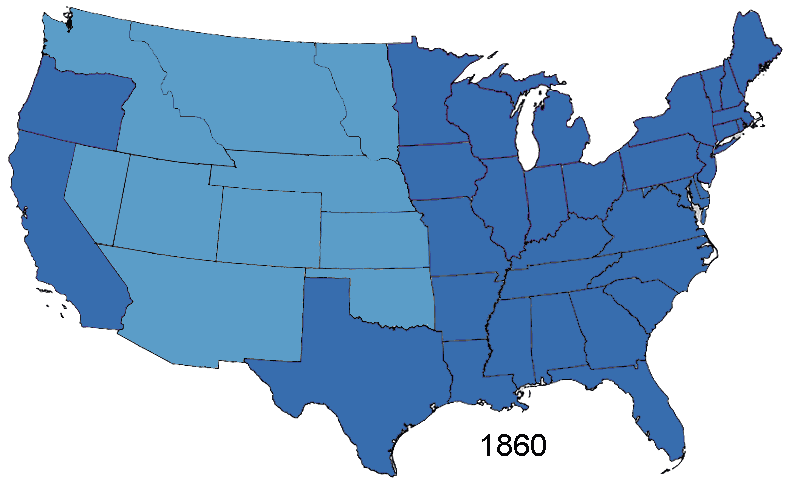
Animated map, about the American Civil War and the restoration of the southern states and the Union (made in Photoshop).
States of the Union (with full delegations in the U.S. Congress)
Union Territories (including the southern states before and during the war)
States of the Confederacy
Territories of the Confederacy
Licence:
Credit:
Based on Creative Commons Licenced 1861 map and GNU-1864 Licenced map. Information from the Wikipedia articles Confederate States of America, List of US states by date of statehood, and has also just exterior sites When states Became states. Civil war borders Used from public domain Perry-Castañeda Library Map Collection 1861-1865 map. Border Between Arizona Territory (CSA) and New Mexico Territory Is That Depicted in public domain map Image: Map of CSA 4.png
Sdílet obrázek:


Relevantní obrázky
.svg)
.svg)
.svg)
.svg)

Relevantní články
Unie (americká občanská válka)Názvem Unie se za americké občanské války označovaly státy Severu, válčící proti státům Jihu, sdruženým v Konfederaci. .. pokračovat ve čtení