Victoria Lagunajf3335 06
Autor:
Přisuzování:
Obrázek je označen jako „Vyžadováno uvedení zdroje“ (Attribution Required), ale nebyly uvedeny žádné informace o přiřazení. Při použití šablony MediaWiki pro licence CC-BY byl pravděpodobně parametr atribuce vynechán. Autoři zde mohou najít příklad pro správné použití šablon.
Shortlink:
Zdroj:
Formát:
4608 x 3456 Pixel (7042569 Bytes)
Popis:
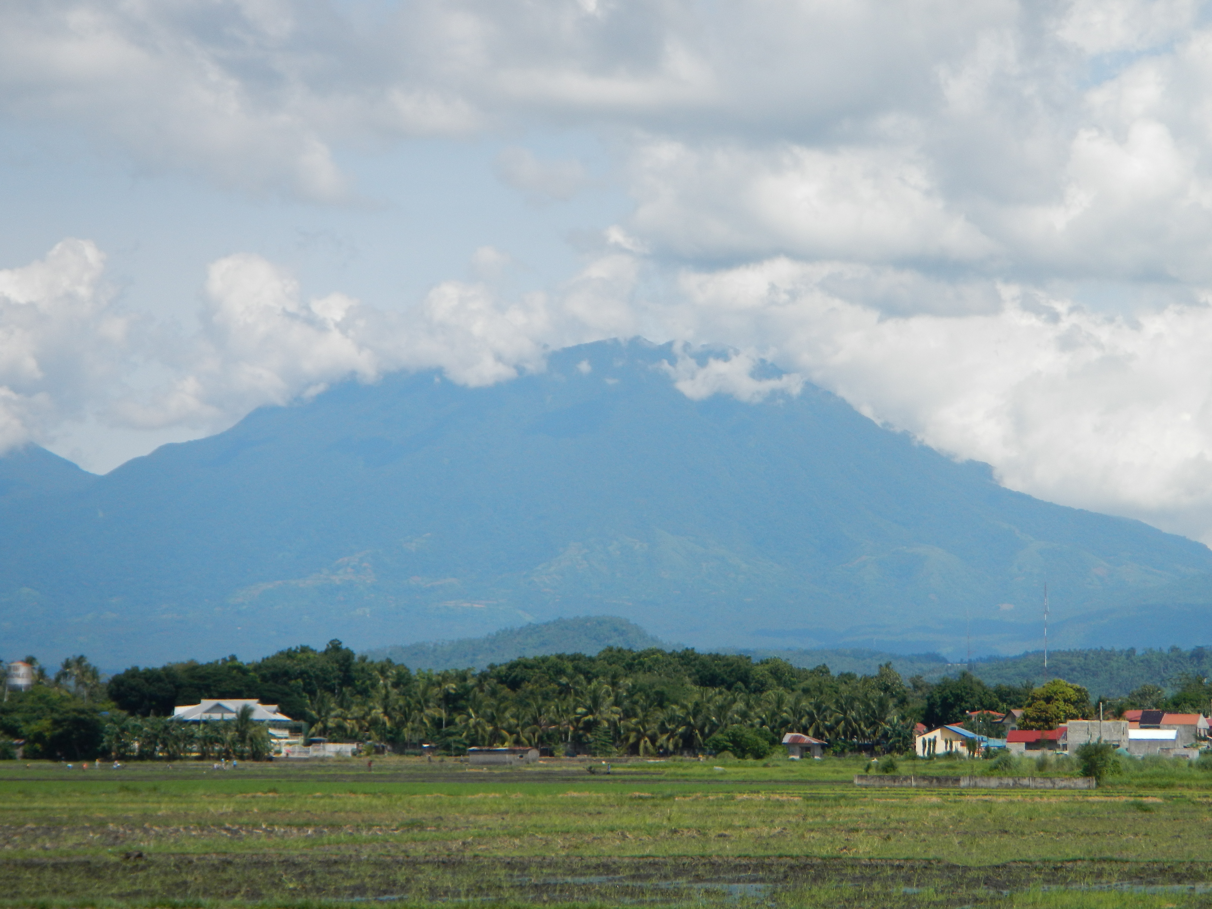
Scenic roads, rice fields and mountain ranges in Barangay San Francisco, Victoria (to the National Highway - the golden-green rice fields with the view of high mountains - ranges in Laguna: the mystic Mt. Banahaw and the legendary Mt. Makiling).[1] Map of San Francisco, Victoria, Philippines [2] [3] - Victoria, Laguna[4] is a fourth class municipality in the province of Laguna, [5] Philippines. According to the latest census, it has a population of 34,604 people.
It is southeast of Laguna de Bay, [6] 90 kilometres (56 mi) south of Manila and bordered by the Municipality of Calauan[7] to the southwest, Nagcarlan to the southeast and Pila[8] to the northeast. The municipality has a total land area of 22.83 square kilometres which is 1.30% of the total land area of the province of Laguna. Its name was adopted from President Quirino's daughter Victoria Quirino. [9] After Pateros became highly urbanized and densely populated, Victoria became a destination of balut traders and became the "Duck[10] Raising Center of the Philippines". The town was featured as the detour challenge of Leg 11 of the 5th Season[11] of the Amazing Race[12]. Victoria celebrate their Itik Festival every last week of April. Victoria is politically subdivided into 9 barangays. Two of these, Nanhaya and San Roque, are classified as urban while the rest are rural. Banca-banca, Nanhaya (Pob.), San Francisco, inter alia. Municipal officials 2010-2013: Mayor: Nonong Gonzalez Vice Mayor: Florencio "Toknie" M. Larańo [13] Coordinates: 14°11'56"N 121°20'22"E [14] [15] This place is situated in Laguna, Region 4, Philippines, its geographical coordinates are 14° 13' 37" North, 121° 19' 39" East and its original name (with diacritics) is Victoria.
Licence:
Credit:
Vlastní dílo
Sdílet obrázek:


Relevantní obrázky


Relevantní články
BanahawBanahaw je aktivní sopka na filipínském ostrově Luzon. S výškou 2 170 m je nejvyšší horou provincií Laguna a Quezon. Její území patří do chráněné přírodní památky Banahaw – San Cristobal, dosahující rozlohy 109 km². V současnosti je sopka nečinná, k poslední erupci došlo roku 1909, ale panují o ní pochybnosti. .. pokračovat ve čtení