WW2-Holocaust-Europe-2007Borders
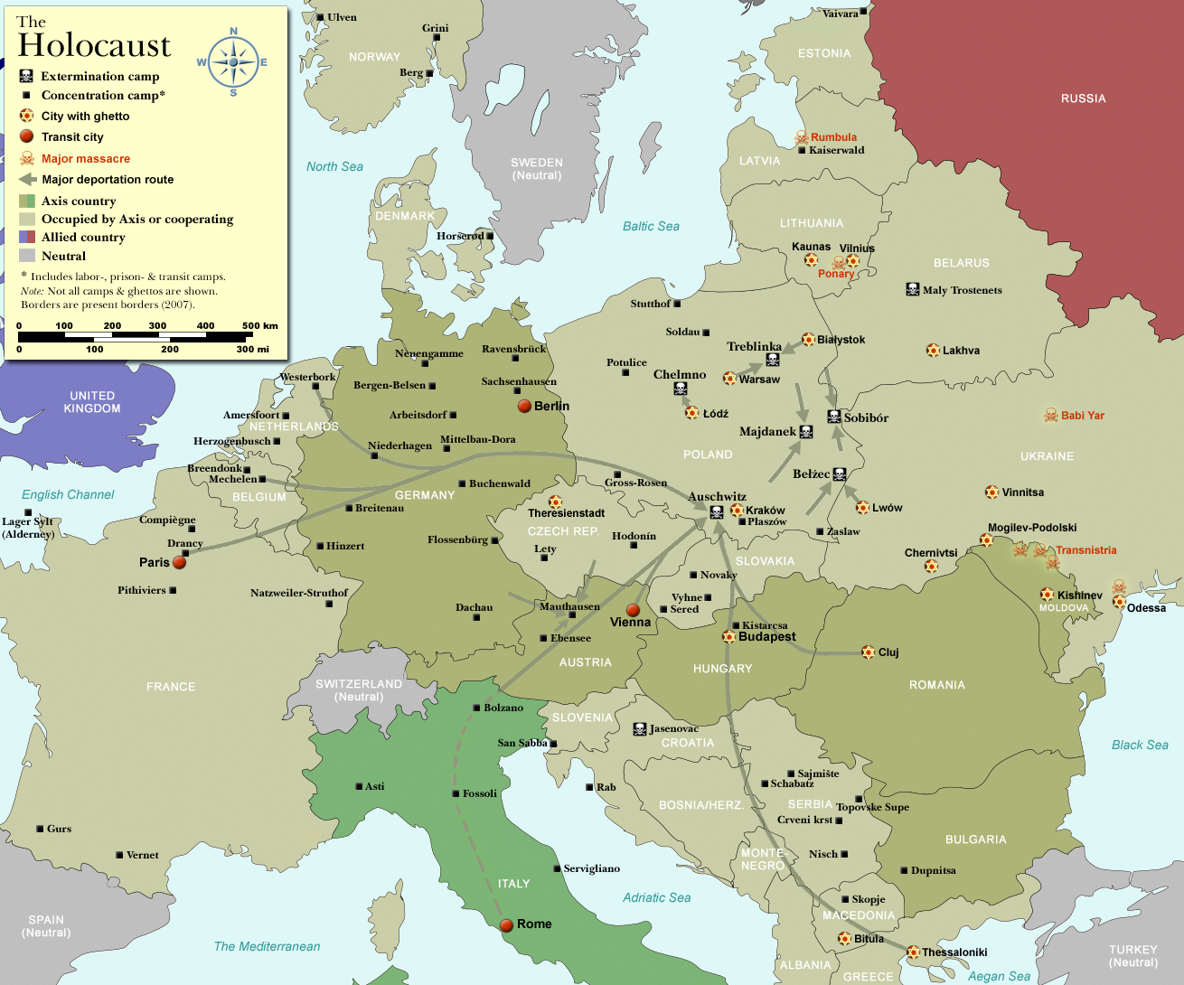
Map of the Holocaust in Europe during World War II, 1939-1945.
This map shows all extermination camps (or death camps), most major concentration camps, labor camps, prison camps, ghettos, major deportation routes and major massacre sites. Please note that a version with 1942 borders is available here: Image:WW2-Holocaust-Europe.png.
Notes:
1. Extermination camps were dedicated death camps, but all camps and ghettos took a toll of many, many lives.
2. Concentration camps include labor camps, prison camps & transit camps.
3. Not all camps & ghettos are shown.
4. Borders are present borders (2007).
Übersetzung der "Notes" bis hierher:
1. Extermination camps = Vernichtungslager als Fachbegriff für ganz bestimmte Konzentrationslager.
2. Concentration camps umfassen hier auch Arbeitslager, Gefängnislager und Transitlager.
3. Nicht alle Konzentrationslager werden gezeigt.


Relevantní články
Seznam německých koncentračních táborůSeznam německých koncentračních táborů obsahuje přehled Němci zbudovaných koncentračních táborů před a v průběhu druhé světové války. .. pokračovat ve čtení