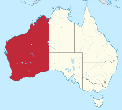
Western Australia - November 10, 2013
Jeff Schmaltz MODIS Land Rapid Response Team,
NASA GSFCThe 2013-2014 bushfire in Western Australia was well underway in early November, with dozens of fires visible from space.
The Moderate Resolution Imaging Spectroradiometer (MODIS) aboard NASA’s Terra satellite captured this true-color image on November 10, 2013. Fires speckle the landscape from the coastal regions in the northwest, through the more southerly, arid inland regions.
According to Accuweather.com, the 2013/14 Australian Bush Fire season is being forecast to be even more serious than last year’s. Higher than average rainfall across Australia for the last 2 years has sparked abundant grass growth, which, when combined with high temperatures, creates a heavy fuel as the dry season progresses. The combination of high temperatures, large fuel loads, and high winds creates conditions ripe for high intensity, fast running grass fires throughout much of Australia during the current bushfire season.| This file is in the public domain in the United States because it was solely created by NASA. NASA copyright policy states that "NASA material is not protected by copyright unless noted". (See Template:PD-USGov, NASA copyright policy page or JPL Image Use Policy.) |  | |
 |
Warnings:
|
Relevantní obrázky
Relevantní články
Západní AustrálieZápadní Austrálie je největší australský spolkový stát, rozkládající se v západní třetině Austrálie. Po ruském Jakutsku je to druhý největší územně správní celek na světě. Stát hraničí na východě s Jižní Austrálií a Severním Teritoriem, na jihu, západě a severu je omýván vodami Indického oceánu. .. pokračovat ve čtení


