Western Han Mawangdui Silk Map
Autor:
Anonymous ancient Chinese cartographer
Shortlink:
Zdroj:
Formát:
3675 x 3549 Pixel (3216005 Bytes)
Popis:
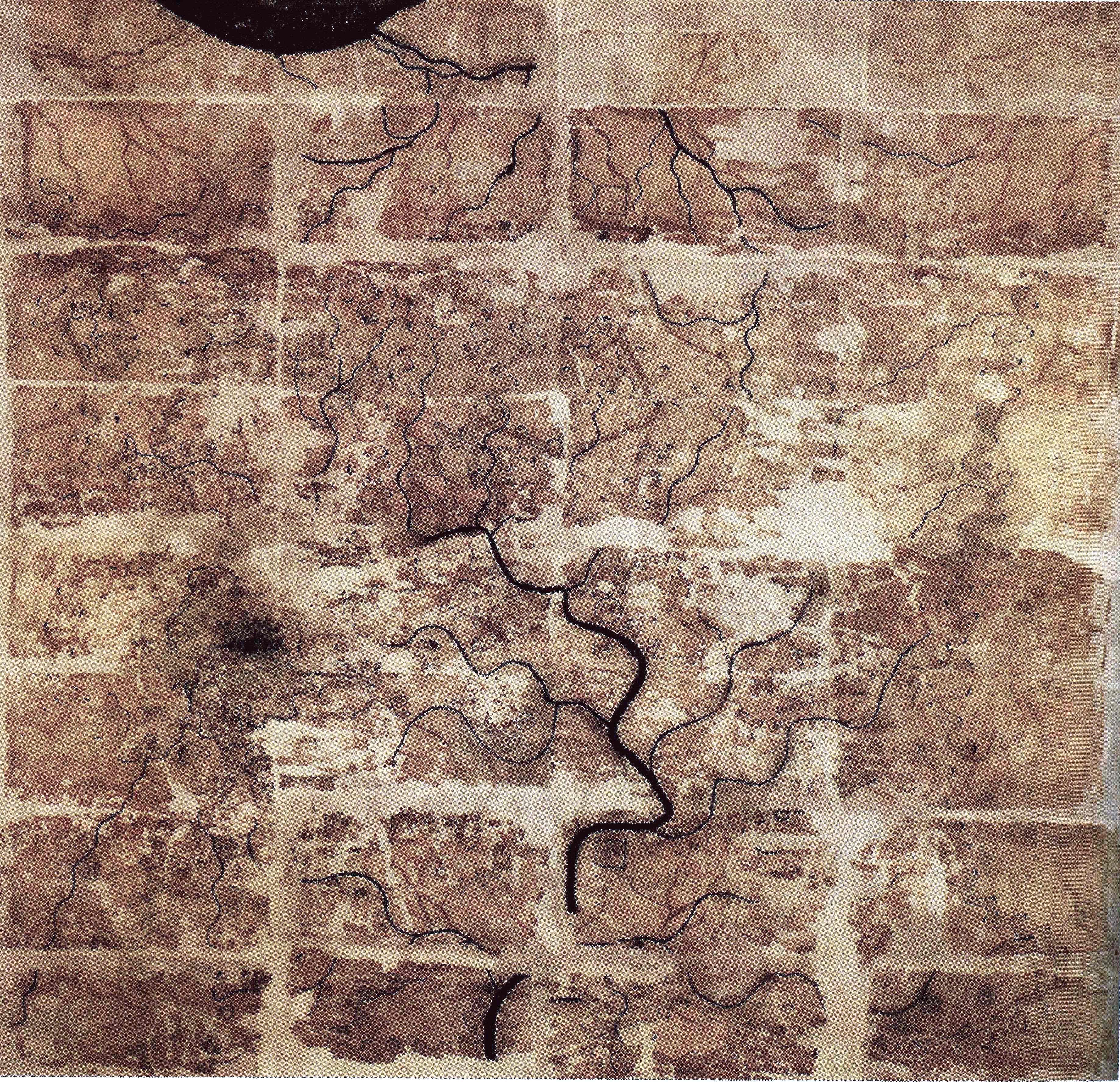
A Chinese topographic map (with the south positioned at the top) from Mawangdui tomb 3; dated to the early Western Han period (183–168 BC); length is 96 cm; width is 96 cm; the map is made of ink on silk. It is now housed in the Hunan Provincial Museum, Changsha. The map depicts a large territory in southern China spanning from the imperial fiefdom of Changsha (a semi-autonomous kingdom within the Han Empire, now modern-day Hunan) to the independent and sometimes hostile Kingdom of Nanyue in what is now modern-day Guangdong and northern Vietnam.
Licence:
Public domain
Credit:
Scanned from Barbieri-Low, Anthony J. (2007). Artisans in Early Imperial China. Seattle and London: University of Washington Press. ISBN 0295987138. Page 174.
Sdílet obrázek:


Relevantní obrázky


Relevantní články
Dynastie ChanDynastie Chan je čínská dynastie, která vládla v období 206 př. n. l.–220 n. l. Předcházela ji dynastie Čchin a po ní následovalo období tří království. .. pokračovat ve čtení