Cape hatteras 1989
Autor:
NASA
Shortlink:
Zdroj:
Formát:
5300 x 5270 Pixel (11734877 Bytes)
Popis:
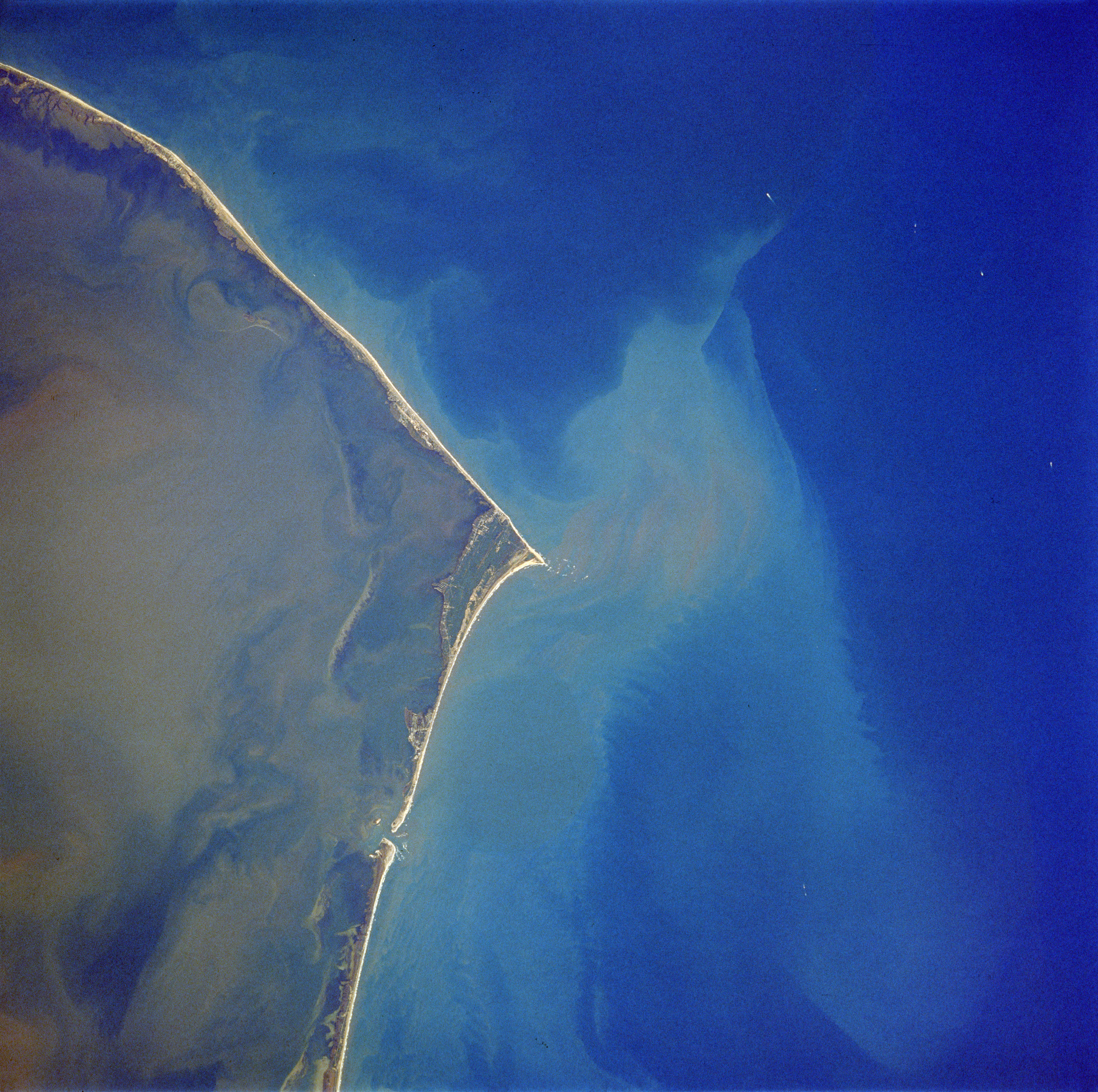
Cape Hatteras, North Carolina, USA - October 1989
- The famous barrier island coast of Cape Hatteras, is visible in this near vertical of the North Carolina coast. This barrier island system is protected as the Cape Hatteras National Seashore, with Pamlico Sound to the west and the Atlantic Ocean to the east. A plume of sediment, visible off of the tip of Cape Hatteras, creates a light blue color in the Atlantic Ocean waters. This outflow is from the precipitation runoff of Hurricane Hugo (Sept. 1989) which was still evident during the STS-34 mission (Oct. 1989). This same delayed or extended runoff phenomenon was also very marked along the periphery of the Yucatan Peninsula following Hurricane Gilbert in 1988.
Licence:
Public domain
Sdílet obrázek:


Relevantní obrázky
.jpg)

.jpg)


Relevantní články
Mys HatterasMys Hatteras, anglicky Cape Hatteras, je mys na pobřeží Severní Karolíny. Je to místo, kterým Severní Amerika zasahuje nejdále na jihovýchod do Atlantského oceánu. Mys leží v ohybu ostrova Hatteras. .. pokračovat ve čtení
PobřežíPobřeží je přilehlá oblast styku mezi pevninou a oceánem, která je v mapách zakreslována jako linie. .. pokračovat ve čtení