Cassini-OntarioLacus-RADAR
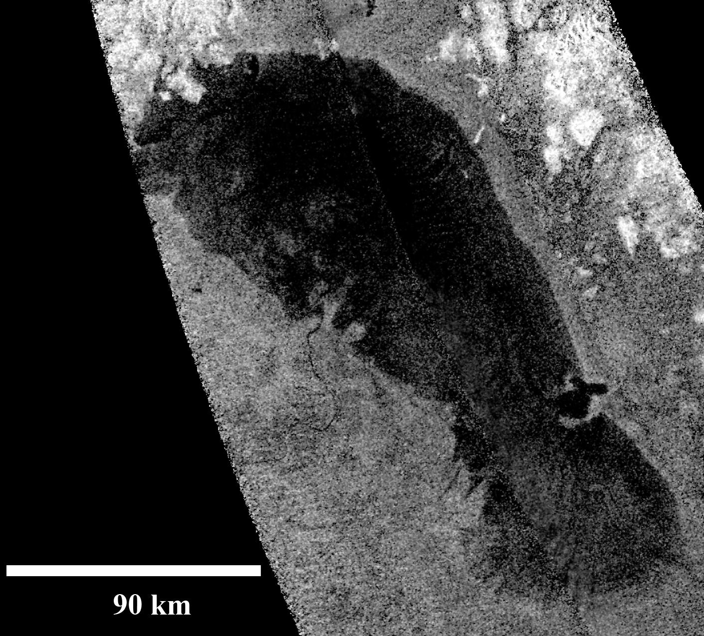
Objects appear bright in this radar image when they are tilted toward the spacecraft or have rough surfaces. The lake surface appears dark because it is smooth. The northern shoreline features flooded river valleys and hills as high as 1 kilometer (3,000 feet) in altitude. A smooth, wave-sculpted shoreline, like that seen on the southeastern side of Lake Michigan, can be seen at the northeastern part of the lake. Smooth lines parallel to the current shoreline could be formed by low waves over time, which were likely driven by winds sweeping in from the west or southwest. The southeast shore features a round-headed bay intruding into the shore. The liquid-filled depressions appear to be relatively recent. The middle part of the western shoreline shows the first well-developed delta observed on Titan. The shape of the delta shows that liquid flowing down from a higher plain has switched channels on its way into the lake, forming at least two lobes.
Examples of this kind of channel switching and wave-modified deltas can be found on Earth at the southern end of Lake Albert between Uganda and the Democratic Republic of Congo in Africa and the remains of an ancient lake known as Megachad in the African country Chad.


Relevantní obrázky


Relevantní články
Ontario LacusOntario Lacus je jezero na Saturnově měsíci Titanu, nacházející se na jižní polokouli, a které se skládá z metanu, propanu a etanu. Jeho uhlíkovodíkové složení bylo potvrzeno sondou Cassini a zveřejněno 31. července 2008 časopisem Nature. Má rozlohu zhruba 15 tisíc kilometrů čtverečních, o 20 % méně, než jeho pozemský jmenovec, Ontarijské jezero v Severní Americe. V dubnu 2012 bylo oznámeno, že to může být spíše wattové pobřeží nebo solná pánev. .. pokračovat ve čtení